Category:Maps of Saint-Jean-de-Losne
Jump to navigation
Jump to search
Wikimedia category | |||||
| Upload media | |||||
| Instance of | |||||
|---|---|---|---|---|---|
| Category combines topics | |||||
| Saint-Jean-de-Losne | |||||
commune in Côte-d'Or, France    | |||||
| Instance of | |||||
| Location |
| ||||
| Located in or next to body of water | |||||
| Population |
| ||||
| Area |
| ||||
| official website | |||||
 | |||||
Media in category "Maps of Saint-Jean-de-Losne"
The following 4 files are in this category, out of 4 total.
-
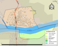
 21554-Saint-Jean-de-Losne-Hydro.jpeg 5,846 × 4,133; 1.73 MB
-
 21554-Saint-Jean-de-Losne-Sols.png 3,270 × 2,598; 1.53 MB
-
 Canton Saint Jean de Losne.svg 447 × 507; 122 KB
-
 Map commune FR insee code 21554.png 756 × 605; 17 KB


