Category:Maps of Saint-Marcellin (Isère)
Jump to navigation
Jump to search
Wikimedia category | |||||
| Upload media | |||||
| Instance of | |||||
|---|---|---|---|---|---|
| Category combines topics | |||||
| Saint-Marcellin | |||||
commune in Isère, France   _OSM_01.png) | |||||
| Instance of | |||||
| Location |
| ||||
| Population |
| ||||
| Area |
| ||||
| Elevation above sea level |
| ||||
| official website | |||||
 | |||||
Media in category "Maps of Saint-Marcellin (Isère)"
The following 13 files are in this category, out of 13 total.
-
 38-AAV2020-Saint-Marcellin.png 3,519 × 2,930; 2.74 MB
-
 38-Saint-Marcellin-AAV2020.png 3,519 × 2,930; 1.39 MB
-
 38416-Saint-Marcellin - Localisation.png 2,480 × 2,480; 1.24 MB
-
 38416-Saint-Marcellin-Cadastre.png 7,015 × 4,960; 11.93 MB
-
 38416-Saint-Marcellin-Hydro.png 7,015 × 4,960; 8.91 MB
-
 38416-Saint-Marcellin-Sols.png 3,270 × 2,598; 4.01 MB
-
 Baillage de Saint-Marcellin - Gouvernement général du Dauphiné - 1751.png 1,653 × 1,102; 4.18 MB
-
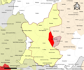
 Map commune FR insee code 38416.png 756 × 605; 85 KB
-

-

-
 Réduction des plans d'ensemble du Cadastre - Détroyat del. - btv1b53087528d.jpg 5,440 × 3,504; 1.65 MB
-
 Saint-Marcellin (Isère) OSM 01.png 439 × 552; 159 KB
-
 Saint-Marcellin (Isère) OSM 02.png 439 × 552; 292 KB


_-_btv1b53006709z.jpg)


_OSM_02.png)