Category:Maps of Saint-Pierre-lès-Nemours
Jump to navigation
Jump to search
Wikimedia category | |||||
| Upload media | |||||
| Instance of | |||||
|---|---|---|---|---|---|
| Category combines topics | |||||
| Saint-Pierre-lès-Nemours | |||||
commune in Seine-et-Marne, France     | |||||
| Instance of | |||||
| Location | |||||
| Located in or next to body of water | |||||
| Head of government |
| ||||
| Population |
| ||||
| Area |
| ||||
| official website | |||||
 | |||||
Subcategories
This category has the following 3 subcategories, out of 3 total.
Media in category "Maps of Saint-Pierre-lès-Nemours"
The following 9 files are in this category, out of 9 total.
-
 77431-Saint-Pierre-lès-Nemours - Localisation.png 2,500 × 2,480; 1.42 MB
-
 77431-Saint-Pierre-lès-Nemours - Relief-PlanIgn.png 7,015 × 4,960; 15.26 MB
-
 77431-Saint-Pierre-lès-Nemours-Cadastre.png 7,015 × 4,960; 9.96 MB
-
 77431-Saint-Pierre-lès-Nemours-Hydro.png 7,015 × 4,960; 6.45 MB
-
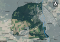 77431-Saint-Pierre-lès-Nemours-Orthophoto.png 7,015 × 4,960; 9.91 MB
-
 77431-Saint-Pierre-lès-Nemours-Sols.png 7,015 × 4,960; 5.03 MB
-
 Map commune FR insee code 77431.png 756 × 605; 58 KB
-
 Saint-Pierre-lès-Nemours OSM 01.png 474 × 481; 257 KB
-
 Saint-Pierre-lès-Nemours OSM 03.png 474 × 481; 274 KB


