Category:Maps of Saint-Sardos (Tarn-et-Garonne)
Jump to navigation
Jump to search
Wikimedia category | |||||
| Upload media | |||||
| Instance of | |||||
|---|---|---|---|---|---|
| Category combines topics | |||||
| Saint-Sardos | |||||
commune in Tarn-et-Garonne, France .JPG) _OSM_03.png) | |||||
| Instance of | |||||
| Location |
| ||||
| Population |
| ||||
| Area |
| ||||
| Elevation above sea level |
| ||||
| Different from | |||||
| official website | |||||
 | |||||
Media in category "Maps of Saint-Sardos (Tarn-et-Garonne)"
The following 10 files are in this category, out of 10 total.
-
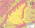 82173-Saint-Sardos-argile.jpg 3,057 × 2,480; 646 KB
-
 82173-Saint-Sardos-Natura2000.png 5,846 × 4,133; 9.78 MB
-
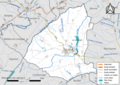 82173-Saint-Sardos-Routes-Hydro.png 3,507 × 2,480; 2.44 MB
-
 82173-Saint-Sardos-Sols.png 3,270 × 2,598; 2.45 MB
-
 82173-Saint-Sardos-ZNIEFF1.png 3,057 × 2,480; 4.1 MB
-
 82173-Saint-Sardos-ZNIEFF2.png 3,519 × 2,480; 4.69 MB
-
 Map commune FR insee code 82173.png 756 × 605; 65 KB
-
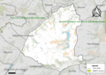
 Saint-Sardos (Tarn-et-Garonne) OSM 01.png 514 × 535; 187 KB
-
 Saint-Sardos (Tarn-et-Garonne) OSM 02.png 514 × 535; 384 KB
-
 Saint-Sardos (Tarn-et-Garonne) OSM 03.png 514 × 535; 267 KB


_OSM_01.png)
_OSM_02.png)