Category:Maps of Sainte-Gemme (Gironde)
Jump to navigation
Jump to search
Wikimedia category | |||||
| Upload media | |||||
| Instance of | |||||
|---|---|---|---|---|---|
| Category combines topics | |||||
| Sainte-Gemme | |||||
commune in Gironde, France   | |||||
| Instance of | |||||
| Location |
| ||||
| Street address |
| ||||
| Population |
| ||||
| Area |
| ||||
| Elevation above sea level |
| ||||
| Different from | |||||
 | |||||
Subcategories
This category has only the following subcategory.
Media in category "Maps of Sainte-Gemme (Gironde)"
The following 9 files are in this category, out of 9 total.
-
 33404-Sainte-Gemme-argile.jpg 3,057 × 2,480; 450 KB
-
 33404-Sainte-Gemme-Routes-Hydro.png 3,507 × 2,480; 1.6 MB
-
 33404-Sainte-Gemme-Sols.png 3,270 × 2,598; 1.74 MB
-
 33404-Sainte-Gemme-ZNIEFF2.png 5,866 × 4,133; 5.25 MB
-
 Map commune FR insee code 33404.png 756 × 605; 41 KB
-
 Sainte-Gemme (Gironde) dans son Arrondissement.png 2,000 × 2,467; 646 KB
-
 Sainte-Gemme (Gironde) Limite communale.jpg 955 × 577; 189 KB
-
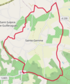 Sainte-Gemme (Gironde) OSM 01.png 302 × 359; 102 KB
-
 Sainte-Gemme (Gironde) OSM 03.png 426 × 451; 274 KB


_dans_son_Arrondissement.png)
_Limite_communale.jpg)
_OSM_01.png)
_OSM_03.png)