Category:Maps of Sainte-Orse
Jump to navigation
Jump to search
Wikimedia category | |||||
| Upload media | |||||
| Instance of | |||||
|---|---|---|---|---|---|
| Category combines topics | |||||
| Sainte-Orse | |||||
commune in Dordogne, France   | |||||
| Instance of | |||||
| Location |
| ||||
| Population |
| ||||
| Area |
| ||||
 | |||||
Subcategories
This category has the following 5 subcategories, out of 5 total.
E
G
H
T
Media in category "Maps of Sainte-Orse"
The following 3 files are in this category, out of 3 total.
-
 24473-Sainte-Orse-SIC.png 4,677 × 3,307; 8.96 MB
-
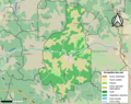 24473-Sainte-Orse-Sols.png 3,270 × 2,598; 2.42 MB
-
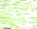 Map commune FR insee code 24473.png 756 × 605; 52 KB

