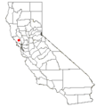
Category:Maps of Santa Rosa, California
Jump to navigation
Jump to search
Subcategories
This category has only the following subcategory.
Media in category "Maps of Santa Rosa, California"
The following 5 files are in this category, out of 5 total.
-
Bird's eye view of Santa Rosa, Sonoma County, Cal., 1876. LOC 76693083.jpg 8,000 × 5,536; 7.51 MB
-
CA 5 certified.pdf 1,275 × 1,650; 1,003 KB
-
California US Congressional District 5 (since 2013).tif 2,016 × 998; 2.75 MB
-
CAMap-doton-Santa Rosa.png 209 × 230; 4 KB
-
CotatiCensusMap76485024.png 575 × 425; 49 KB


