Category:Maps of Santiago (Galápagos)
Jump to navigation
Jump to search
Media in category "Maps of Santiago (Galápagos)"
The following 7 files are in this category, out of 7 total.
-
 Galapagos Island Names (alternate font).png 260 × 344; 27 KB
-
 Galapagos Islands topographic map-en.svg 2,160 × 2,160; 2.62 MB
-
 Galapagos Santiago highlighted.svg 280 × 326; 34 KB
-
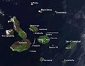 Galapagos-satellite-esislandnames.jpg 674 × 525; 48 KB
-
 Santiago (Galapagos) topographic map-de.png 3,548 × 2,485; 1.51 MB
-
 Santiago (Galapagos) topographic map-en.png 3,548 × 2,485; 1.52 MB
-
 Santiago (Galapagos) topographic map-es.png 3,548 × 2,485; 1.53 MB
.png)


_topographic_map-de.png)
_topographic_map-en.png)
_topographic_map-es.png)