Category:Maps of Santorini
Jump to navigation
Jump to search
Subcategories
This category has the following 2 subcategories, out of 2 total.
O
- Old maps of Santorini (31 F)
T
Media in category "Maps of Santorini"
The following 23 files are in this category, out of 23 total.
-
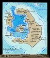
ETH-BIB-Santorin, Ereignis-Folge-Dia 247-Z-00414.tif 2,890 × 3,494; 29.01 MB
-
ETH-BIB-Santorin, Fouque Kaimeni 1925, nach C.A. Kténas-Dia 247-Z-00222.tif 3,600 × 2,991; 30.94 MB
-
ETH-BIB-Santorin, Kaimenai 1826-1925, nach Fouque Kténas-Dia 247-Z-00221.tif 3,645 × 2,991; 31.32 MB
-
ETH-BIB-Santorin, Karte und Zugersee-Dia 247-Z-00212.tif 2,904 × 3,372; 28.16 MB
-
ETH-BIB-Santorin, Karte zum Wandtafel-Einzeichnen der geolog. Ereignis-Reihe-Dia 247-Z-00303.tif 2,994 × 2,235; 19.24 MB
-
ETH-BIB-Santorin, Karte-Dia 247-09000.tif 3,128 × 3,163; 28.44 MB
-
ETH-BIB-Santorin, Karte-Dia 247-09001.tif 3,110 × 3,116; 27.85 MB
-
ETH-BIB-Santorin, Karte-Dia 247-09004.tif 2,987 × 3,410; 29.25 MB
-
ETH-BIB-Santorin, Tiefenkarte (Kurven)-Dia 247-Z-00213.tif 2,863 × 3,330; 27.43 MB
-
GR Thira.PNG 626 × 536; 21 KB
-
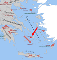
Kykladen-santorini.png 1,484 × 1,202; 199 KB
-
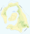
Map of Thera before the Minoan eruption (Druitt, Francaviglia).png 1,171 × 1,349; 173 KB
-
Map of Thera before the Minoan eruption.png 1,171 × 1,349; 179 KB
-
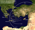
Minoan Ash.png 580 × 500; 423 KB
-
OPAP Santorin.png 493 × 522; 125 KB
-
Santorin-Krater (Karte).png 176 × 176; 6 KB
-
Santorin.png 2,000 × 2,000; 1.42 MB
-
Santorini topo.jpg 999 × 1,064; 163 KB
-
Santorini-topo-HEB.svg 551 × 677; 415 KB
-
Santorini-topo-pt.svg 512 × 629; 67 KB
-
Santorini-topo.svg 551 × 677; 255 KB
-
Santorini2022OSM.png 4,618 × 4,861; 4.4 MB
-
Thera impact on Nile delta.gif 800 × 600; 47 KB


