Category:Maps of Schwerin
Jump to navigation
Jump to search
Districts of Mecklenburg-Western Pomerania:
Wikimedia category | |||||
| Upload media | |||||
| Instance of | |||||
|---|---|---|---|---|---|
| Category combines topics | |||||
| Schwerin | |||||
capital city of Mecklenburg-Vorpommern, Germany  Castillo de Schwerin     | |||||
| Instance of |
| ||||
| Location | |||||
| Located in or next to body of water |
| ||||
| Head of government |
| ||||
| Founded by | |||||
| Inception |
| ||||
| Population |
| ||||
| Area |
| ||||
| Elevation above sea level |
| ||||
| Different from | |||||
| Said to be the same as | Schwerin | ||||
| official website | |||||
 | |||||
Subcategories
This category has the following 2 subcategories, out of 2 total.
O
- Old maps of Schwerin (12 F)
T
- Tram maps of Schwerin (6 F)
Media in category "Maps of Schwerin"
The following 32 files are in this category, out of 32 total.
-
 Altstadt in Schwerin.png 944 × 1,086; 173 KB
-
 Aubach bei Schwerin.png 649 × 1,552; 67 KB
-
 Bezirk des LG Schwerin.PNG 528 × 485; 95 KB
-
 Bezirk des VG Schwerin.PNG 400 × 284; 16 KB
-
 Friedrichsthal in Schwerin.png 944 × 1,086; 173 KB
-
 Gartenstadt in Schwerin.png 944 × 1,086; 150 KB
-
 Grosser Dreesch in Schwerin.png 944 × 1,086; 173 KB
-
 Karausche Schwerin.png 391 × 522; 334 KB
-
 Karte Marstall Schwerin.png 1,416 × 982; 623 KB
-
 Krebsfoerden in Schwerin.png 944 × 1,086; 173 KB
-
 Kreis Schwerin-Land im Bezirk Schwerin.png 418 × 587; 8 KB
-
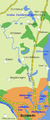
 Lage der Seen Schwerin Nord.png 790 × 582; 33 KB
-
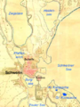
 Lage der Seen Schwerin.png 988 × 564; 55 KB
-
 Lankow in Schwerin.png 944 × 1,086; 173 KB
-
 Locator map SN in Mecklenburg-Vorpommern.svg 1,129 × 775; 260 KB
-
 Mecklenburg-Vorpommern SN 2011.svg 1,129 × 775; 1.55 MB
-
 Mecklenburg-Vorpommern SN.svg 1,129 × 775; 472 KB
-
 Muesser Holz in Schwerin.png 944 × 1,086; 173 KB
-
 Neu Zippendorf in Schwerin.png 944 × 1,086; 173 KB
-
 Neumuehle in Schwerin.png 944 × 1,086; 173 KB
-
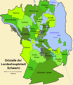 Ortsteile Schwerin Karte.png 944 × 1,086; 173 KB
-
 Ostorf in Schwerin.png 944 × 1,086; 150 KB
-
 Schelfstadt in Schwerin.png 944 × 1,086; 173 KB
-
 Schwerin Alter Garten Karte.png 982 × 983; 417 KB
-
 Schwerin Feldstadt Karte OSM.png 2,000 × 1,684; 1.49 MB
-
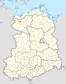 Schwerin in German Democratic Republic.svg 618 × 789; 3 MB
-
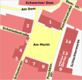 Schwerin Markt Plan.png 1,964 × 1,911; 750 KB
-
 Schwerin subdivisions.svg 1,047 × 1,047; 865 KB
-
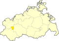
 Schwerin-Position.png 188 × 235; 5 KB
-
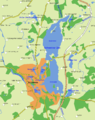 Schwerinersee.png 1,897 × 2,403; 312 KB
-
 SN in Mecklenburg-Vorpommern.svg 859 × 607; 84 KB
-
 Warnitz in Schwerin.png 944 × 1,086; 173 KB


