Category:Maps of Scotland
Pereiti į navigaciją
Jump to search
Constituent countries of the United Kingdom: Anglija · Šiaurės Airija · Škotija · Velsas – British Crown dependencies: Džersis · Gernsis · Meno Sala
British overseas territories: Akrotiris ir Dekelija · Angilija · Bermuda · Britų Antarktidos teritorija · Folklando Salos · Gibraltaras · Indijos Vandenyno Britų Sritis · Kaimanų salos · Mergelių Salos · Pietų Džordžijos ir Pietų Sandvičo Salos · Pitkerno salos · Šv. Elena, Kilimo Dangun sala ir Tristanas de Kunja · Terksas ir Kaikosas
British overseas territories: Akrotiris ir Dekelija · Angilija · Bermuda · Britų Antarktidos teritorija · Folklando Salos · Gibraltaras · Indijos Vandenyno Britų Sritis · Kaimanų salos · Mergelių Salos · Pietų Džordžijos ir Pietų Sandvičo Salos · Pitkerno salos · Šv. Elena, Kilimo Dangun sala ir Tristanas de Kunja · Terksas ir Kaikosas
Wikimedia category | |||||
| Įkelti mediją | |||||
| Tai yra | |||||
|---|---|---|---|---|---|
| Kategorija sujungia temas | |||||
 | |||||
Subkategorijos
Rodomos 52 subkategorijos (iš viso yra 52 subkategorijos).
- Maps of Scotland by year (1 F)
!
*
A
B
D
- Drainage basin maps of Scotland (49 F)
F
- Flag maps of Scotland (6 F)
G
- Glen Tilt - maps (2 F)
H
L
- Location maps of Scotland (11 F)
M
- Maps of Eigg (8 F)
- Maps of islands of Scotland (6 F)
- Maps of River Clyde (22 F)
- Maps of River Forth (12 F)
- Maps of Solway Firth (17 F)
- Maps of Staffa (island) (8 F)
- Maps of the Firth of Tay (12 F)
- Maps of mountains of Scotland (1 P, 94 F)
N
O
- OpenStreetMap maps of Scotland (56 F)
P
- Postcode maps covering Scotland (24 F)
R
S
- Siccar Point - maps (4 F)
T
Puslapiai kategorijoje „Maps of Scotland“
Rodomi 2 šios kategorijos puslapiai (iš viso kategorijoje yra 2 puslapiai).
Daugialypės terpės rinkmenos kategorijoje „Maps of Scotland“
Rodomi 195 šios kategorijos rinkmenos (iš viso kategorijoje yra 195 rinkmenos).
-
 Scotland map-en.jpg 2 400 × 3 450; 2,17 MiB
-
 Scotland map-fr.jpg 2 400 × 3 450; 2,21 MiB
-
 052023-whisky-map-high-quality-export.jpg 9 934 × 14 044; 7,91 MiB
-
 14thC Scottish Economy.jpg 632 × 702; 80 KiB
-
 2018-01-01-00 00 2018-01-01-23 59 CORINE Land Cover Corine Land Cover (22).jpg 1 024 × 528; 247 KiB
-
 A9 Scotland.jpg 1 780 × 2 300; 1,4 MiB
-
 A92 Scotland.png 960 × 1 380; 1,45 MiB
-
 A93 Scotland.png 1 080 × 1 553; 1,75 MiB
-
 A94 Scotland.png 1 080 × 1 553; 1,75 MiB
-
 Anglo-Scottish.border.modern.png 600 × 592; 586 KiB
-
 Basic Population Distribution of Scotland.png 1 048 × 1 664; 158 KiB
-
 BIThumbMap SCO.png 663 × 1 069; 112 KiB
-
 Boat of Garten Elgin, Keith & Portessie RJD 38.JPG 2 688 × 1 719; 756 KiB
-
 Bothwell-kart.jpg 191 × 247; 9 KiB
-
 BrideiCamp.jpg 830 × 1 154; 214 KiB
-
 Britische Hauptlinien Eisenbahn-Diagramm Waverley Line.png 698 × 933; 303 KiB
-
 British and Irish Isles after Scottish independence.png 4 765 × 6 618; 2,38 MiB
-
 Brochs from Canmore (all).png 700 × 700; 198 KiB
-
 Brochs from Canmore (excluding possibles).png 700 × 700; 192 KiB
-
 Cartina Scozia Nord Est.png 584 × 771; 323 KiB
-
 Celtic countries.svg 547 × 979; 242 KiB
-
 Chwe Chenedl Geltaidd syml gyda Baneri.svg 360 × 711; 210 KiB
-
 Chwe Chenedl Geltaidd syml.png 360 × 711; 12 KiB
-
 Chwe Chenedl Geltaidd.png 430 × 711; 12 KiB
-
 ClanMacaulay-map-lochbroom01.png 692 × 1 340; 101 KiB
-
 Clyde.catchment.Scotland.jpg 826 × 1 307; 205 KiB
-
 Clyde.tributaries.jpg 1 300 × 1 600; 328 KiB
-
 Corrieyairack Pass Map.png 982 × 651; 27 KiB
-
 Council areas Scotland.gif 455 × 720; 49 KiB
-
 COVID-19 Map of Scotland.png 1 345 × 1 668; 273 KiB
-
 Cowal peninsula landsat.jpg 948 × 1 280; 340 KiB
-
 Cowal peninsula landsat.png 948 × 1 280; 2,19 MiB
-
 Cruachan horseshoe2.jpg 1 128 × 693; 103 KiB
-
 Cumbrae locale.jpg 300 × 283; 51 KiB
-
 Delvine och Tay samt högland Kopia.png 740 × 400; 13 KiB
-
 Dhùn Bheagan.svg 1 334 × 1 424; 1,56 MiB
-
 Early Medieval Economy.jpg 632 × 702; 80 KiB
-
 Early Medieval Scotland - Zones.png 794 × 969; 1,44 MiB
-
 Ecosse carte physique.png 300 × 400; 34 KiB
-
 Edinburgh Zoo location.png 240 × 216; 32 KiB
-
 EMRS Map.png 369 × 534; 52 KiB
-
 EMRSmap.jpg 1 830 × 2 512; 743 KiB
-
 Europe location SCO 2.png 1 600 × 1 200; 567 KiB
-
 Europe location SCO 3.png 1 600 × 1 200; 519 KiB
-
 Europe location SCO2.png 1 594 × 1 194; 558 KiB
-
 Farm Medium.jpg 436 × 600; 39 KiB
-
 Fife coastal path map.jpg 954 × 790; 409 KiB
-
 Fionnla Dubh mac Gillechriosd (map).png 785 × 719; 805 KiB
-
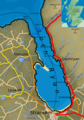
 Firthofclydemap.png 541 × 611; 18 KiB
-
 FirthofLornmap.png 538 × 573; 17 KiB
-
 Fullarton estate 1828.jpg 4 256 × 3 184; 1,52 MiB
-
 Galloway.modern.names.Ptolemy.map.png 1 200 × 913; 41 KiB
-
 Galloway.rivers.towns.jpg 2 467 × 1 568; 296 KiB
-
 Garve to Ullapool Railway Sketch Map.jpg 610 × 599; 135 KiB
-
 Glasgow map.png 220 × 326; 8 KiB
-
 Hebridesmap.png 935 × 1 450; 61 KiB
-
 Highland PICT Map.jpg 446 × 440; 42 KiB
-
 Highland towns.gif 360 × 390; 43 KiB
-
 Highlands costa occidentale 3000000 best.png 498 × 833; 224 KiB
-
 Highlands location.png 647 × 766; 683 KiB
-
 Highlands lowlands fr.png 584 × 768; 179 KiB
-
 Highlands nord.png 686 × 717; 269 KiB
-
 Isles 1266.jpg 706 × 1 176; 339 KiB
-
 ITV network microregions in Scotland map 2015.svg 486 × 791; 255 KiB
-
 Kincardine and Deeside.svg 1 023 × 1 345; 2,82 MiB
-
 Kingdom of Man and the Isles map (island groups).png 1 065 × 1 805; 1,82 MiB
-
 Kyle and Carrick.svg 1 023 × 1 345; 2,82 MiB
-
 Laid 1.gif 347 × 500; 158 KiB
-
 Leod Macgilleandrais (map).png 786 × 692; 711 KiB
-
 Lieux de L'Abbé, de Walter Scott.png 1 224 × 714; 39 KiB
-
 Ljótólfr (map).png 555 × 743; 128 KiB
-
 Location of Auchencairn.png 692 × 684; 122 KiB
-
 Location of the Beecraigs Country Park.jpg 916 × 621; 388 KiB
-
 Lochalsh sketch map.jpg 909 × 634; 199 KiB
-
 Lochalsh.jpg 922 × 655; 52 KiB
-
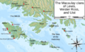 Macaulay of Lewis map.png 1 290 × 800; 1,09 MiB
-
 Map of Celtic Nations (alternate).svg 675 × 1 300; 90 KiB
-
 Map of Celtic Nations.svg 675 × 1 300; 97 KiB
-
 Map of Loch Ryan.png 530 × 758; 321 KiB
-
 Map of Oswald distribution in Scotland 1690-1800.jpg 454 × 692; 165 KiB
-
 Map of Scotland, with rites in archaeology. Wellcome M0002544.jpg 1 345 × 1 583; 302 KiB
-
 Map of Speir's school.jpg 3 776 × 2 960; 2,55 MiB
-
 Map of the Almondell & Calderwood Country Park.jpg 915 × 608; 557 KiB
-
 MapOfAyrshire.png 302 × 326; 29 KiB
-
 MapOfAyrshire.svg 300 × 323; 21 KiB
-
 Mapping a group pool, revisited (4382146079).png 584 × 568; 208 KiB
-
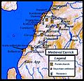 Medieval carrick.jpg 720 × 696; 136 KiB
-
 Melrose map.jpg 191 × 247; 9 KiB
-
 NHS Health Boards.PNG 420 × 546; 15 KiB
-
 Olvir Rosta article map.png 795 × 1 235; 1 MiB
-
 Outerhebridesharris.png 1 500 × 1 562; 109 KiB
-
 Paul Mactire map.png 845 × 503; 524 KiB
-
 Perth and Kinross 1999.svg 596 × 747; 820 KiB
-
 Perth Burghs Constituency 1707-1832.svg 323 × 449; 2,11 MiB
-
 Pictish kingdoms with Fidach.png 230 × 285; 50 KiB
-
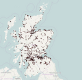
 Population density map in Scotland from the 2011 census.png 11 578 × 17 178; 13,84 MiB
-
 Provinces of South-West Scotland.jpg 975 × 762; 179 KiB
-
 RCHAMSInventories.png 400 × 457; 51 KiB
-
 Regions2011.png 1 000 × 1 245; 150 KiB
-
 Renfrewshire map.png 220 × 326; 8 KiB
-
 RenfrewshireCraigends.png 200 × 149; 6 KiB
-
 Revised Royal Regiment of Scotland recruiting areas.png 2 551 × 1 912; 224 KiB
-
 Revised Royal Regiment of Scotland recruiting areas2.png 2 551 × 1 912; 226 KiB
-
 Revised Royal Regiment of Scotland recruiting areas4.png 5 728 × 5 136; 762 KiB
-
 Revised Royal Regiment of Scotland recruiting areas5.jpg 5 728 × 5 136; 1,11 MiB
-
 Rhins of Galloway Map.png 1 206 × 2 230; 1,11 MiB
-
 Rhu Peninsula map 1 location legend.svg 2 199 × 1 005; 1,18 MiB
-
 Rhu Peninsula map 1.svg 1 805 × 1 005; 329 KiB
-
 River Forth course 3.png 2 000 × 806; 981 KiB
-
 Roman Catholicism in Scotland.png 1 128 × 1 483; 315 KiB
-
 Royal Regiment of Scotland recruiting areas.png 2 551 × 1 912; 155 KiB
-
 SCOport-fr-parts.png 1 200 × 1 200; 193 KiB
-
 Scotch regions.png 498 × 383; 10 KiB
-
 Scotch regions.svg 700 × 700; 61 KiB
-
 Scotland (0 Shetland) council areas.png 2 305 × 2 799; 721 KiB
-
 Scotland (core) council areas.png 1 420 × 1 153; 265 KiB
-
 Scotland Administrative 2009 Blank.png 1 000 × 1 625; 457 KiB
-
 Scotland Administrative Map 1947.png 2 001 × 3 480; 2,32 MiB
-
 Scotland ayres and language.jpg 779 × 1 024; 310 KiB
-
 Scotland council areas.gif 500 × 770; 38 KiB
-
 Scotland grevskap.jpg 800 × 994; 105 KiB
-
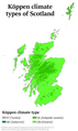 Scotland Köppen.png 5 400 × 9 062; 414 KiB
-

-
-
 Scotland locator map 2 September 2007 - equidistant cylindrical.png 905 × 732; 96 KiB
-

-
 Scotland locator map 23 August 2007 - bordered island.png 431 × 656; 70 KiB
-
 Scotland locator map 23 August 2007 - comparison.png 553 × 933; 186 KiB
-
 Scotland locator map 23 August 2007 - island.png 431 × 656; 70 KiB
-
 Scotland Map (Firth of Clyde Detail).png 250 × 158; 15 KiB
-
 Scotland map of whisky distilleries-de.png 2 401 × 2 712; 5,93 MiB
-
 Scotland map of whisky distilleries-fr.jpg 2 400 × 3 455; 1,43 MiB
-
 Scotland map.png 253 × 372; 30 KiB
-
 Scotland Map.png 1 120 × 770; 23 KiB
-
 Scotland region map (ru).svg 2 308 × 3 207; 1,09 MiB
-
 Scotland region map.svg 2 308 × 3 207; 1,09 MiB
-
 Scotland registration districts 2005.svg 789 × 840; 4,52 MiB
-
 Scotland sections of Munro's tables.jpg 1 419 × 1 958; 327 KiB
-
 Scotland slope map 50 m.png 12 179 × 13 532; 64,17 MiB
-
 Scotland, map for "Lijst van golfbanen in Scholtand".jpg 1 127 × 1 483; 241 KiB
-
 Scotland-Tour-22 (26840794509).png 1 620 × 1 920; 4,63 MiB
-
 Scotland-Tour-27 (24745005668).png 1 620 × 1 920; 4,63 MiB
-
 Scotland-Tour-ALL (38584791902).png 1 620 × 1 920; 4,64 MiB
-
 Scotland1974Numbered.png 400 × 457; 47 KiB
-
 Scotland1996Blank.png 1 616 × 1 848; 60 KiB
-
 ScotlandCountiesBlank.png 1 616 × 1 848; 61 KiB
-
 ScotlandCountiesNumbered.png 400 × 457; 78 KiB
-
 ScotlandLabelled.png 251 × 476; 51 KiB
-
 ScotlandLieutenancies.png 400 × 458; 65 KiB
-
 Scotlland satellite image.jpg 614 × 576; 91 KiB
-
 Scotloc original.png 126 × 212; 3 KiB
-
 Scotloc topo dark.png 118 × 180; 25 KiB
-
 Scotloc topo light.PNG 118 × 180; 26 KiB
-
 Scottish 1996 council areas flood damage July 24 2007.png 548 × 626; 24 KiB
-
 Scottish 1997 non-administrative counties flood damage July 24 2007.png 548 × 627; 25 KiB
-
 Scottish clan map blank.png 1 065 × 1 400; 121 KiB
-
 Scottish clan map.png 1 065 × 1 400; 450 KiB
-
 Scottish council areas 2003.svg 1 023 × 1 345; 2,87 MiB
-
 Scottish council areas and national parks.jpg 1 023 × 1 345; 139 KiB
-
 Scottish counties flood damage July 24 2007.png 1 616 × 1 848; 123 KiB
-
 Scottish Highlands and Lowlands.png 584 × 768; 185 KiB
-
 Scottish Parliament constituencies.svg 905 × 1 500; 2,06 MiB
-
 ScottishBusOperators.png 514 × 626; 104 KiB
-
 Sgùrr nan Ceathreamhnan.png 1 874 × 1 324; 4,43 MiB
-
 ShintyNorthSouthDistricts.GIF 529 × 759; 22 KiB
-
 Skócia térkép.png 354 × 386; 31 KiB
-
 Smc map.jpg 217 × 297; 14 KiB
-
 South Scotland (Scottish Parliament electoral region).svg 599 × 746; 593 KiB
-
 Spey.catchment.Scotland.jpg 826 × 1 307; 204 KiB
-
 Spey.tributaries.jpg 1 196 × 1 015; 195 KiB
-
 Ss rain 08071412.jpg 453 × 500; 24 KiB
-
 Stewartry and Carrick 4.png 490 × 600; 257 KiB
-
 Stroma OS map.png 1 174 × 1 550; 151 KiB
-
 STV microregions map 2015 (long captions).svg 486 × 791; 245 KiB
-
 STV microregions map 2015 (short captions).svg 486 × 791; 239 KiB
-
 T.S.West 1976 Macaulay Institute, Aberdeen.jpg 1 562 × 2 345; 1,42 MiB
-
 Tay.catchment.Scotland.jpg 826 × 1 307; 204 KiB
-
 Tay.tributaries.jpg 1 600 × 1 024; 256 KiB
-
 Topographical Map of Traditional Galloway.png 1 479 × 1 114; 909 KiB
-
 Tweed.catchment.Scotland.jpg 826 × 1 307; 203 KiB
-
 Tweed.tributaries.jpg 1 600 × 1 118; 263 KiB
-
 WallsAdrian.jpg 1 080 × 1 336; 147 KiB
-
 Waverley Line.png 2 438 × 1 993; 3,08 MiB
-
 Welcome to Scotland's seas.png 3 543 × 2 362; 3,34 MiB
-
 West of scotland population.png 711 × 579; 90 KiB
-
 West of scotland2.png 677 × 586; 62 KiB
-
 Whisky distilleries and regions in Scotland (Updated).svg 2 400 × 2 800; 8,06 MiB
-
 Whisky distilleries and regions in Scotland updated June 2020.svg 512 × 724; 6,54 MiB
-
 Whisky distilleries and regions in Scotland.svg 2 400 × 2 800; 7,06 MiB
-
 Whiskyregionenkarte Schottlands.png 660 × 782; 74 KiB
-
 Wolf of Badenoch Lands2.jpg 2 500 × 2 500; 745 KiB
-
 Yezhoù Bro-Skos.jpg 512 × 697; 74 KiB
-
 You are Here - geograph.org.uk - 1441895.jpg 640 × 480; 80 KiB
-
 Þórketill Þórmóðsson (map).png 1 195 × 1 709; 2,08 MiB
-
 스코틀랜드 독립투표.png 900 × 509; 34 KiB


.jpg)


.png)
.png)


.png)


.png)


.png)

.png)


.svg)


.png)


_council_areas.png)
_council_areas.png)


.png)


.svg)


.png)
.png)
.png)


.svg)


.svg)
.svg)


.svg)


.png)
