Category:Old maps of Scotland
Jump to navigation
Jump to search
Constituent countries of the United Kingdom: England · Northern Ireland · Scotland · Wales – British Crown dependencies: Bailiwick of Guernsey · Isle of Man · Jersey
British overseas territories: Bermuda · Falkland Islands · Gibraltar · Pitcairn Islands · South Georgia and the South Sandwich Islands
British overseas territories: Bermuda · Falkland Islands · Gibraltar · Pitcairn Islands · South Georgia and the South Sandwich Islands
Use the appropriate category for maps showing all or a large part of Scotland. See subcategories for smaller areas:
| If the map shows | Category to use |
|---|---|
| Scotland on a recently created map | Category:Maps of Scotland or its subcategories |
| Scotland on a map created more than 70 years ago | Category:Old maps of Scotland or its subcategories |
| the history of Scotland on a recently created map | Category:Maps showing history of Scotland or its subcategories |
| the history of Scotland on a map created more than 70 years ago | Category:Old maps of the history of Scotland or its subcategories |
Subcategories
This category has the following 19 subcategories, out of 19 total.
Media in category "Old maps of Scotland"
The following 200 files are in this category, out of 288 total.
(previous page) (next page)-

-

-

-

-
 "Southerlandia" (22072260979).jpg 4,073 × 3,038; 2.4 MB
-
 "Strath- Navernia = Strath-Navern - Auct. Timotheo Pont" (21636337084).jpg 3,618 × 3,036; 2.09 MB
-
 054 schottland (1905).png 1,187 × 1,789; 1.45 MB
-

-

-

-

-

-

-
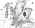
 Scotland from the Matthew Paris map, c.1250.jpg 522 × 399; 103 KB
-

-

-

-

-

-
-
 Bodleian Libraries, Central Scotland.jpg 672 × 1,000; 139 KB
-
 Bodleian Libraries, Scotland, divided by rivers.jpg 672 × 1,000; 136 KB
-

-

-

-

-

-

-
 Atlas Ortelius KB PPN369376781-009av-009br.jpg 3,000 × 2,194; 4.73 MB
-
-
 Map of Scotland by Abraham Ortelius.jpeg 2,895 × 2,336; 2.4 MB
-
 Scotia Regnum (5376153482).jpg 1,024 × 859; 771 KB
-
 Scotiae regnum (5376154222).jpg 1,024 × 837; 783 KB
-
 Scotiae regnum or Seconde table d'Escosse (5376151568).jpg 1,024 × 857; 841 KB
-
-
 Scotia regnum - CBT 6586588.jpg 5,911 × 4,531; 7.02 MB
-
 Atlas Van der Hagen-KW1049B11 038-SCOTIA REGNUM cum insulis adjacentibus.jpeg 5,500 × 4,276; 3.53 MB
-
 Blaeu - Atlas of Scotland 1654 - SCOTIA ANTIQUA - Old Scotland.jpg 6,492 × 4,975; 8.4 MB
-
 Blaeu - Atlas of Scotland 1654 - SCOTIA REGNUM - Kingdom of Scotland.jpg 6,492 × 5,000; 9.41 MB
-
 BlaeuMap1654Fife&Lothian.jpg 1,645 × 845; 1.65 MB
-

-

-

-

-

-
 Scotia Antiqva… - Atlas Maior, vol 6, map 2 - Joan Blaeu, 1667 - BL 114.h(star).6.(2).jpg 4,000 × 3,413; 2.25 MB
-
 Scotia Regnvm - Atlas Maior, vol 6, map 3 - Joan Blaeu, 1667 - BL 114.h(star).6.(3).jpg 4,000 × 3,405; 2.34 MB
-

-

-
 Mapofscotland.jpeg 324 × 464; 33 KB
-
 Scotland (NYPL b14428893-1503436).jpg 5,248 × 6,299; 7.42 MB
-
 Map of Scotland, 1685* (another view).jpg 620 × 900; 429 KB
-
 UBBasel Map Schottland Färöer Shetlandinseln Orkneyinseln Hebriden 1685-1686 Kartenslg Mappe 238-46.tif 3,344 × 4,466, 2 pages; 42.75 MB
-
 A new map of Scotland with the roads (8643653080).jpg 5,187 × 4,291; 21.34 MB
-

-
 Scotiae provintiae inter Taum fluvium et septentrionales oras Angliae - CBT 6590013.jpg 5,807 × 4,760; 8.02 MB
-
 A new chart of the sea coast of SCOTLAND with the Island thereof NYPL1640560.tiff 7,230 × 5,428; 112.28 MB
-

-
 The north part of Great Britain called Scotland. NYPL1630443.tiff 7,230 × 5,100; 105.5 MB
-
 1747 La Feuille Map of Scotland - Geographicus - Ecosse-ratelband-1747.jpg 2,500 × 1,769; 1.77 MB
-
 LEcosse divisée en shires ou comtés (5375554561).jpg 1,024 × 731; 592 KB
-

-

-
 Isaak tirion, atlante, 1769.jpg 2,548 × 1,860; 3.97 MB
-
 1772 Bonne Map of Scotland - Geographicus - Scotland-bonne-1772.jpg 3,500 × 2,522; 2.16 MB
-
-
 Houghton F 6649.20 - James Anderson, Hebrides and Scotland, 1785.jpg 1,921 × 2,293; 1.74 MB
-
 Karte von Scotland.jpg 6,958 × 9,782; 21.18 MB
-
 1794 Campbell Map of Scotland - Geographicus - Scotland-campbell-1794.jpg 5,032 × 6,000; 8.43 MB
-
 Geography Bewitched - Scotland.jpg 4,117 × 5,214; 7.38 MB
-
 The figure of a woman representing the map of Scotland. Etch Wellcome V0040811.jpg 2,409 × 2,939; 3.84 MB
-
 Karte von Scotland, nach Dorret.jpg 9,572 × 7,065; 18.85 MB
-
 1799 Clement Cruttwell Map of Scotland - Geographicus - Scotland-cruttwell-1799.jpg 3,062 × 3,500; 2.72 MB
-
 1801 Cary Map of Scotland (4 Sheets) - Geographicus - Scotland-cary-1801.jpg 7,000 × 6,322; 13.91 MB
-
 Map of Scotland Wellcome V0049912.jpg 2,439 × 2,945; 3.66 MB
-

-

-
 Scotland southern part.jpg 9,480 × 6,904; 23.66 MB
-
 Map of Scotland Wellcome L0048593.jpg 3,648 × 4,062; 3.54 MB
-
 1815 Thomson Map of Southern Scotland - Geographicus - ScotlandSouth-t-15.jpg 5,000 × 4,224; 3.74 MB
-
 Map of Scotland (5376154728).jpg 832 × 1,024; 849 KB
-
 1818 Pinkerton Map of Northern Scotland - Geographicus - ScotlandNorth-pinkerton-1818.jpg 5,000 × 3,724; 4.71 MB
-
 1818 Pinkerton Map of Southern Scotland - Geographicus - ScotlandSouth-pinkerton-1818.jpg 5,000 × 3,711; 5.78 MB
-

-
 Gray1824.southscotland.jpg 960 × 739; 152 KB
-
 1827 Finley Map of Scotland - Geographicus - Scotland-finley-1827.jpg 2,327 × 3,000; 2.1 MB
-
 Eglinton by John Thomson 1828.jpg 3,872 × 2,848; 3.09 MB
-

-
 Lion United Kingdom 1843.jpg 1,344 × 1,888; 2.78 MB
-
 1855 Colton Map of Scotland - Geographicus - Scotland-colton-1855.jpg 2,904 × 3,500; 3.53 MB
-
 Scotland LOC 2012593343.jpg 4,464 × 5,933; 5.27 MB
-
 Scotland LOC 2012593343.tif 4,464 × 5,933; 75.77 MB
-
 The tourist's map of Scotland LOC 2012593344.jpg 4,425 × 5,081; 4.93 MB
-
 The tourist's map of Scotland LOC 2012593344.tif 4,425 × 5,081; 64.33 MB
-

-

-
 1864 Mitchell Map of Ireland and Scotland - Geographicus - IrelandScotland-mitchell-1864.jpg 4,000 × 3,216; 3.03 MB
-

-

-
 1866 Johnson Map of Scotland and Ireland - Geographicus - ScotlandIreland-johnson-1866.jpg 4,000 × 2,629; 3.65 MB
-
 Scotland (8250971174).jpg 1,675 × 2,000; 3.49 MB
-

-

-
 Scotland Physical Map 1880.jpg 4,794 × 5,866; 2.87 MB
-
 Map of Scotland (GW Bacon).jpg 9,270 × 12,198; 27.47 MB
-
 'The Green Ray' by Léon Benett 16.jpg 422 × 700; 83 KB
-
 Scottish geographical magazine (1885) (14597588800).jpg 3,236 × 2,432; 1.26 MB
-
 Scottish geographical magazine (1885) (14761301576).jpg 3,034 × 2,266; 1.42 MB
-
 Scottish geographical magazine (1885) (14784107695).jpg 1,666 × 1,968; 558 KB
-

-
 1891 Scotland Languages.jpg 633 × 858; 234 KB
-
 1892 Tourist's New Map of Scotland - Geographicus - Scotland-bartholomew-1892.jpg 3,500 × 4,567; 4.73 MB
-
 Hysgeir island.jpg 2,880 × 3,936; 1.15 MB
-

-
 Maps.nls.uk 7440 74400863 100 native.jpg 11,968 × 9,392; 17.37 MB
-
 A fauna of the Tay Basin and Strathmore (1906) (14749298794).jpg 2,340 × 3,624; 772 KB
-
 A fauna of the Tay Basin and Strathmore (1906) (14751661995).jpg 4,192 × 2,740; 2.71 MB
-

-

-

-
-

-

-

-

-

-

-

-

-

-

-

-

-

-

-

-
 39 of 'Cusack's Reign of Queen Elizabeth for scholarship candidates' (11233625745).jpg 1,786 × 1,216; 556 KB
-

-

-

-

-

-
-

-
 61 of 'Our Journey to the Hebrides' (11202780096).jpg 1,837 × 1,200; 564 KB
-
 61 of 'The Round World ... New edition, revised, etc' (11114936656).jpg 641 × 1,037; 192 KB
-

-

-

-

-

-

-

-
-

-

-
 95 of 'St. Kilda past and present' (11127956073).jpg 1,504 × 2,223; 803 KB
-

-

-

-

-

-

-
 A chart of the east coast of Scotland. NYPL1640567.tiff 7,230 × 5,428; 112.28 MB
-
 A commercial map of Scotland with the roads, stages and distances RMG K0903.jpg 1,034 × 1,280; 1.31 MB
-

-
 A fauna of the Tay Basin and Strathmore (1906) (14564967880).jpg 2,340 × 3,616; 684 KB
-
 A fauna of the Tay Basin and Strathmore (1906) (14728635056).jpg 2,404 × 3,672; 813 KB
-
 A large draught of the Isle of Orkney and Shetland with the north part of SCOTLAND. NYPL1640561.tiff 11,310 × 5,400; 174.76 MB
-

-

-
 A new map of Scotland - from the latest authorities - btv1b531027465.jpg 12,797 × 11,233; 27.26 MB
-

-
 A short history of England and the British Empire (1915) (14580513028).jpg 3,056 × 2,104; 704 KB
-
 A short history of England and the British Empire (1915) (14580591398).jpg 1,916 × 2,868; 878 KB
-
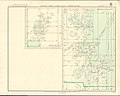
 Admiralty Chart Catalogue 1967 Page 020 Index C.jpg 8,584 × 6,824; 8.07 MB
-
 Admiralty Chart Catalogue 1967 Page 023 Index C1.jpg 8,576 × 6,829; 9.33 MB
-
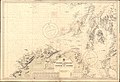 Admiralty Chart No 1577 Western approaches to the Firth of Clyde, Published 1913.jpg 16,242 × 11,122; 53.29 MB
-
 Admiralty Chart No 2397a Firth of Forth to Moray Firth, Published 1863.jpg 13,587 × 11,292; 58.46 MB
-

-
 Admiralty Chart No 245 Scotland to Iceland, Published 1960.jpg 9,872 × 6,797; 15.28 MB
-
 Admiralty Chart No 246 Scotland to Greenland Published 1961.jpg 9,856 × 6,808; 17.28 MB
-
 Admiralty Chart No 2635 Scotland west coast, Published 1886.jpg 16,663 × 24,397; 76.54 MB
-
 Admiralty Chart No 2770 Sound of Barra, 1945, Originally published 1863.jpg 11,160 × 16,299; 26.62 MB
-
 An account of the present state of the Hebrides Fleuron T135827-1.png 3,502 × 3,448; 436 KB
-
 An impartial history of England Fleuron N031583-4.png 2,360 × 1,648; 244 KB
-
 Annals of Scottish natural history (17791855844).jpg 1,934 × 2,932; 1.01 MB
-
 Scotia (NYPL b15404146-1632134).jpg 7,230 × 5,428; 6.39 MB
-
 Baldorran.jpg 1,280 × 513; 473 KB
-
 Balerno Loop 25000 Composite.jpg 6,500 × 3,776; 6.62 MB
-

-
 Battle of Pinkie sketch, 1547.jpg 774 × 1,273; 414 KB
-
 Beaufort's Dyke, cropped from Admiralty Chart No 1577, Published 1913.jpg 4,634 × 3,039; 4.52 MB
-
 Black's picturesque tourist of Scotland (1857) (14782557275).jpg 1,384 × 2,208; 826 KB
-
 Blaeu - Atlas of Scotland 1654 - GLOTTIANA PRÆFECTVRA INFERIOR - Lower Clydesdale.png 2,879 × 1,630; 6.61 MB
-
 Brockhaus and Efron Jewish Encyclopedia e2 513-0.jpg 1,045 × 1,230; 217 KB
-
 CambuslangMap1923.jpg 743 × 580; 102 KB
-

-
 Carte of Scotlande.jpg 404 × 319; 117 KB
-
 Chambers's encyclopædia; a dictionary of universal knowledge (1868) (14756158886).jpg 2,266 × 2,398; 690 KB
.jpg)
.jpg)
.jpg)
.jpg)
.jpg)
.jpg)
.png)
.jpg)
%27_(11162803763).jpg)
.jpg)
%27_(11164979825).jpg)
%27_(11163203214).jpg)

%27_(11164650223).jpg)
.jpg)
%27_(11165276816).jpg)
%27_(11163141126).jpg)
_..._In_two_volumes.)%27_(11002920234).jpg)
.jpg)


%27_(11165087744).jpg)
%27_(11161382085).jpg)
.jpg)
%27_(11163615383).jpg)
%27_(11161126095).jpg)


.jpg)
.jpg)
.jpg)
.jpg)


.jpg)
%22_(22259588395).jpg)
.jpg)
%27_(11165190124).jpg)
.6.(2).jpg)
.6.(3).jpg)
_..._In_two_volumes.)%27_(11002811774).jpg)
%27_(11163076955).jpg)

.jpg)
.jpg)
.jpg)
_ei_undique_praetensas_accurate_divisa_(8643653024).jpg)

.jpg)

.jpg)


.jpg)


_-_Geographicus_-_Scotland-cary-1801.jpg)


.jpg)


%27_(11007497313).jpg)


%27_(11164648876).jpg)

_(14579649569).jpg)
_(14579650019).jpg)

.jpg)
%27_(11162218503).jpg)
.jpg)

.jpg)

_(14597588800).jpg)
_(14761301576).jpg)
_(14784107695).jpg)
_(14576984049).jpg)


.jpg)

_(14749298794).jpg)
_(14751661995).jpg)
_(14779778021).jpg)
.jpg)
%27_(11163913746).jpg)
%27_(11161048195).jpg)
_..._In_two_volumes.)%27_(11002775445).jpg)
%27_(11163954685).jpg)
.jpg)
.jpg)
.jpg)
%27_(11161120376).jpg)
.jpg)
%27_(11282897295).jpg)
.jpg)
.jpg)
.jpg)
.jpg)
.jpg)
.jpg)
.jpg)
.jpg)
.jpg)
%27_(11006109923).jpg)
.jpg)
.jpg)
%27_(11161027416).jpg)
%27_(11250882784).jpg)
.jpg)
.jpg)
.jpg)
.jpg)
.jpg)
.jpg)
%27_(11162783965).jpg)
.jpg)
%27_(11163251143).jpg)
.jpg)
.jpg)
%27_(11165281463).jpg)
.jpg)
.jpg)
.jpg)
%27_(11162611816).jpg)
%27_(11165134323).jpg)
.jpg)
.jpg)
_(14770777115).jpg)


_(14564967880).jpg)
_(14728635056).jpg)


_(14595605839).jpg)
_(14580513028).jpg)
_(14580591398).jpg)


.jpg)
.jpg)

.jpg)


_(14782557275).jpg)


.jpg)

_(14756158886).jpg)
.jpg)
%27_(11161490533).jpg)
_(cropped).jpg)