Category:Maps of Shelter Island, New York
Jump to navigation
Jump to search
Use the appropriate category for maps showing all or a large part of Town of Shelter Island, New York. See subcategories for smaller areas:
| If the map shows | Category to use |
|---|---|
| Town of Shelter Island, New York on a recently created map | [[:Category:Maps of Town of Shelter Island, New York]] or its subcategories |
| Town of Shelter Island, New York on a map created more than 70 years ago | [[:Category:Old maps of Town of Shelter Island, New York]] or its subcategories |
| the history of Town of Shelter Island, New York on a recently created map | [[:Category:Maps of the history of Town of Shelter Island, New York]] or its subcategories |
| the history of Town of Shelter Island, New York on a map created more than 70 years ago | [[:Category:Old maps of the history of Town of Shelter Island, New York]] or its subcategories |
Media in category "Maps of Shelter Island, New York"
The following 7 files are in this category, out of 7 total.
-

-

-
 Dering-harbor-map.png 575 × 425; 18 KB
-
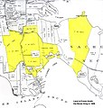 Map1906.jpg 640 × 674; 97 KB
-
 Shelter-island-cdp-map.gif 575 × 425; 40 KB
-
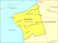
 Shelter-island-heights-map.gif 575 × 425; 45 KB
-
 Shelter-island-town-map.gif 575 × 425; 39 KB


