Category:Maps of St Kilda
Jump to navigation
Jump to search
Media in category "Maps of St Kilda"
The following 35 files are in this category, out of 35 total.
-
SETON(1878) - (1) GEOGRAPHICAL POSITION OF ST. KILDA.jpg 1,961 × 1,541; 1.64 MB
-
SETON(1878) - (2) MAPS OF ST. KILDA.jpg 1,389 × 2,131; 1.73 MB
-
SETON(1878) - p95 Map of Macculoch Island.jpg 2,698 × 1,368; 1.64 MB
-
SETON(1878) - p95 Map of Martin Island.jpg 2,718 × 1,366; 1.6 MB
-
SETON(1878) - p95 Map of Wilson Island.jpg 2,699 × 1,374; 1.77 MB
-
39 of 'St. Kilda past and present' (11124027956).jpg 2,208 × 1,504; 692 KB
-
95 of 'St. Kilda past and present' (11127956073).jpg 1,504 × 2,223; 803 KB
-
Admiralty Chart No 1144 Plans in the Hebrides, Published 1911, Corrections to 1970.jpg 8,116 × 10,986; 16.37 MB
-
Admiralty Chart No 1144 Plans in the Hebrides, Published 1911.jpg 8,235 × 10,929; 24.93 MB
-
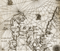
Carte of Scotlande.jpg 404 × 319; 117 KB
-
Hirta - St Kilda - Outer Hebrides.png 485 × 640; 248 KB
-
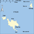
Hirta map.PNG 252 × 286; 7 KB
-
Island of St kildA, J Norman Heathcote, 1900.jpg 4,290 × 4,119; 2.05 MB
-
Kilda2876.png 549 × 500; 27 KB
-
Lucas 1898 Plate 18 St Kilda Macaulay 1764 annalsofvoyageso00luca 0315.jpg 3,841 × 2,997; 1.45 MB
-
Macaulay Map of St Kilda, Published 1764.jpg 7,317 × 6,256; 3.11 MB
-
Ordnance Survey One-inch Sheet 17 North Uist, Published 1959.jpg 8,264 × 9,882; 7.13 MB
-
Ordnance Survey One-Inch Sheet 22 Sollas, Published 1947.jpg 12,167 × 9,255; 36.11 MB
-
Saint Kilda archipelago topographic map-de.svg 1,370 × 1,255; 173 KB
-
Saint Kilda archipelago topographic map-en.svg 1,370 × 1,255; 266 KB
-
Saint Kilda archipelago topographic map-fr.svg 1,370 × 1,255; 286 KB
-
Saint Kilda Map.png 6,480 × 6,480; 9.51 MB
-
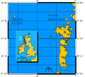
Saint Kilda.PNG 648 × 584; 10 KB
-
Skildar.png 589 × 495; 100 KB
-
St Kilda Map Mathieson 1928.png 9,499 × 7,064; 97.89 MB
-
St Kilda map with Gaelic.PNG 487 × 481; 15 KB
-
St Kilda map, Heathcote.jpg 600 × 442; 19 KB
-
St Kilda map.jpg 3,872 × 3,424; 1.33 MB
-
St Kilda map.png 487 × 481; 14 KB
-
St Kilda OH.svg 1,083 × 1,424; 2.36 MB
-
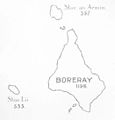
St Kilda, Scotland (Boreray), Heathcote.jpg 347 × 363; 6 KB
-
St-Kilda-3-maps.png 682 × 1,000; 84 KB
-
Stac Lee Location.PNG 648 × 584; 11 KB
-
UK St Kilda.PNG 648 × 584; 19 KB


