Category:Maps of Storebælt
Jump to navigation
Jump to search
Media in category "Maps of Storebælt"
The following 6 files are in this category, out of 6 total.
-
 Dk-wyspy.png 413 × 341; 100 KB
-
 Admiralty Chart No 2116 Great and Little Belts, Published 1852, Large Corrections 1901.jpg 15,942 × 10,910; 72.33 MB
-
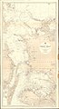
 Admiralty Chart No 2596 Great Belt Northern Portion, Published 1950, New Edition 1971.jpg 11,271 × 16,481; 17.87 MB
-
 Admiralty Chart No 326 Great Belt, Published 1897.jpg 11,342 × 20,968; 69.66 MB
-
 Ageersoe omoe.jpg 864 × 863; 742 KB
-
 БСЭ1. Бельты.jpg 820 × 1,117; 581 KB


