Category:Maps of Suwa Taisha
Jump to navigation
Jump to search
Media in category "Maps of Suwa Taisha"
The following 6 files are in this category, out of 6 total.
-
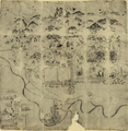 Kamisha-koezu (上社古絵図).png 1,076 × 1,103; 1.7 MB
-
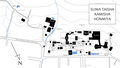 Map of Suwa Shrine, Kamisha Honmiya (English).png 3,440 × 1,950; 649 KB
-
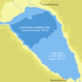 Size of Lake Suwa.png 1,000 × 1,000; 113 KB
-
 フネ古墳の位置 - Location of Fune Kofun.png 1,394 × 660; 249 KB
-
 諏訪大社上社前宮境内図 - Map of Suwa Shrine, Kamisha Maemiya.png 1,500 × 1,600; 498 KB
-
 諏訪大社上社本宮境内図 - Map of Suwa Shrine, Kamisha Honmiya.png 3,440 × 1,950; 688 KB
.png)
.png)


