Category:Maps of Swahili Sultanate
Jump to navigation
Jump to search
Media in category "Maps of Swahili Sultanate"
The following 11 files are in this category, out of 11 total.
-

-
 Africaorientalbritanica1885-1890.PNG 568 × 1,000; 172 KB
-
 Cidades-estado da costa suaíle.png 1,003 × 1,003; 325 KB
-
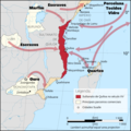
 Culture Swahilie.jpg 324 × 656; 52 KB
-
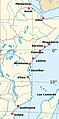
 East Africa, c.1500.jpg 736 × 1,074; 86 KB
-
 Originalkarte des unteren Tana-Gebietes (Denhardt, 1884).png 4,884 × 6,850; 33.88 MB
-
 Pate sultanate.png 1,364 × 2,071; 961 KB
-
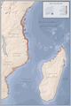
 Sultanate of Kilwa.png 1,819 × 2,739; 1.57 MB
-
 Tanaland (East Africa Protectorate).png 1,012 × 824; 1.24 MB
-
 Witu1890.png 361 × 290; 257 KB
-
 سلطنة كلوة.png 1,819 × 2,739; 1.68 MB
.jpg)


.png)


.png)

