Category:Maps of Tarentaise (Loire)
Jump to navigation
Jump to search
Media in category "Maps of Tarentaise (Loire)"
The following 5 files are in this category, out of 5 total.
-
 42306-Tarentaise-Hydro.jpeg 5,846 × 4,133; 1.97 MB
-
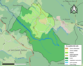 42306-Tarentaise-Sols.png 3,270 × 2,598; 1.68 MB
-
 Diocèse Tarentaise 1789.svg 2,000 × 1,922; 801 KB
-
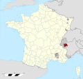
 Map commune FR insee code 42306.png 756 × 605; 48 KB
-
 Province Tarentaise 1789.svg 2,000 × 1,922; 787 KB


