<nowiki>Category:Maps of Tekirdağ Province; categoría de Wikimedia; kategori Wikimedia; Wikimedia category; د ويکيمېډيا وېشنيزه; Vikimedya kategorisi; ویکیمیڈیا زمرہ; kategória projektov Wikimedia; категорія проєкту Вікімедіа; 维基媒体分类; Wikimedia-Kategorie; kategorie na projektech Wikimedia; Wikimedia-Kategorie; विकिपीडिया:श्रेणी; page de catégorie de Wikimedia; kategorija na Wikimediji; विकिपीडिया वर्ग; категорија на Викимедији; Wikimedia-Kategorie; Wikimedia-kategori; kategori Wikimédia; تصنيف ويكيميديا; pajenn rummata eus Wikimedia; Wikimedia:ကဏ္ဍခွဲခြင်း; 維基媒體分類; Wikimedia категориясы; categoría de Wikimedia; Wikimedia-Kategorie; Wikimedia-Kategorie; tudalen categori Wikimedia; kategori e Wikimedias; ردهٔ ویکیپدیا; 维基媒体分类; Wikimedia-kategory; ვიკიპედია:კატეგორიზაცია; ウィキメディアのカテゴリ; categoria Wikimedia; تصنيف بتاع ويكيميديا; විකිමීඩියා ප්රභේද පිටුව; categoria Vicimediorum; Vikipidiya:Shopni; Wikimedia-luokka; Wikimedia category; விக்கிமீடியப் பகுப்பு; катэгорыя ў праекце Вікімэдыя; Викимедиа проектындагы төркем; catigurìa di nu pruggettu Wikimedia; หน้าหมวดหมู่วิกิมีเดีย; Wikimedia:Kategorija; Wikimedia-Kategorie; Wikimedia:Klassys; категория на Уикимедия; categorie a unui proiect Wikimedia; 維基媒體分類; Wikimedia-kategori; kawan Wikimèdia; гурӯҳи Викимедиа; 위키미디어 분류; Wikimedia-bólkur; kategorio en Vikimedio; kategori Wikimedia; categoría de Wikimedia; উইকিমিডিয়া বিষয়শ্রেণী; kategori Wikimedia; 维基媒体分类; וויקימעדיע קאַטעגאָריע; kategorija w projektach Wikimedije; thể loại Wikimedia; Wikimedia projekta kategorija; Wikimedia-kategorie; categoria de um projeto da Wikimedia; 维基媒体分类; категорияд Ангилал; Wikimedia-kategori; kategori Wikimedia; پۆلی ویکیمیدیا; Wikimedia category; Vikimédia ñemohenda; Wikimédia-kategória; વિકિપીડિયા શ્રેણી; Wikimediako kategoria; категория в проекте Викимедиа; Wikimedia-Kategorie; Kategoriya ning Wikimedia; Wikimedia-kategorie; Wîkîmediya:Kategorî; विकिमिडिया श्रेणी; Wikimedia-Kategorie; קטגוריה במיזמי ויקימדיה; Викимедиа проектындагы төркем; κατηγορία εγχειρημάτων Wikimedia; विकिमिडिया श्रेणी; Wikimedia kategooria; Wikimedia-kategoriija; гурӯҳи Викимедиа; jamii ya Wikimedia; Wikimedia:Ronnaghys; 維基媒體分類; categoria di un progetto Wikimedia; Viciméid catagóir; Wikimedia category; categurìa 'e nu pruggette Wikimedia; 維基媒體分類; categoria de Wikimedia; Wikimedia-kategori; Wikimedia proyektındağı törkem; 維基媒體分類; ẹ̀ka Wikimedia; Викимедиина категорија; categoria de um projeto da Wikimedia; kategorija na Wikimediji; Վիքիմեդիայի նախագծի կատեգորիա; tumbung Wikimedia; kategoria ti Wikimedia; kategorija Wikimedie; kategorya ng Wikimedia; Викимедиа категорияһы; Wikimedia-categorie; kategori Wikimedia; kategoria w projekcie Wikimedia; വിക്കിമീഡിയ വർഗ്ഗം; Wikimedia-categorie; kategori Wikimedia; катэгорыя ў праекце Вікімедыя; زمرو:وڪيپيڊيا زمرا بندي; विकिमीडिया श्रेणी; categoría de Wikimedia; Wikimedia-categorie; 维基媒体分类; guruhi Vikimedia</nowiki>
Subcategories
This category has the following 2 subcategories, out of 2 total.


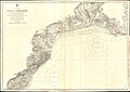 Admiralty Chart No 2605 Erekli to Hora Burnu, Published 1887.jpg 15,250 × 10,857; 48.12 MB
 Cerkezkoy00-Harita.svg 854 × 752; 362 KB
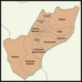 CerkezkoyMahalle.png 1,267 × 1,267; 117 KB
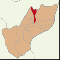 GaziMustafaKemalPasaCerkezkoy.svg 300 × 300; 66 KB
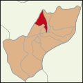 GaziOsmanPasaCerkezkoy.svg 300 × 300; 66 KB
 Hasköy in Malkara.png 720 × 738; 188 KB
 KızılpınarAtaturk.svg 300 × 300; 65 KB
 KızılpınarGultepe.svg 300 × 300; 65 KB
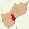 KızılpınarNamikKemal.svg 300 × 300; 65 KB
 Latrans-Turkey location Tekirdağ.svg 1,473 × 655; 10.88 MB
 Locator map-Tekirdağ Province.png 1,024 × 439; 143 KB
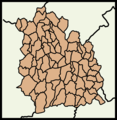 Malkara'nın Mahalleleri.png 746 × 765; 123 KB
 Map of Tekirdağ Fuctional Interaction and Growing Zones 1980-2010.svg 900 × 780; 232 KB
 Tekirdağ harita.svg 1,052 × 744; 37 KB
 Tekirdağ topographic location map.png 501 × 483; 321 KB
 Tekirdağ-Harita.png 854 × 752; 73 KB
 Tekirdağ-Harita.svg 854 × 752; 1.21 MB
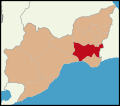 Çorlu-Harita.svg 854 × 752; 362 KB


