Category:Maps of Vallée d'Aure
Jump to navigation
Jump to search
Subcategories
This category has the following 23 subcategories, out of 23 total.
Media in category "Maps of Vallée d'Aure"
The following 11 files are in this category, out of 11 total.
-
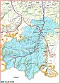 Vallée d'Aure (Hautes-Pyrénées) 2.jpg 1,123 × 1,588; 1.39 MB
-
 Carte de la vallée d'Aure (Hautes-Pyrénées) 1.pdf 4,966 × 7,020; 10.2 MB
-
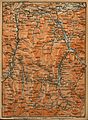
 65 HP 13 4061.jpg 1,155 × 896; 384 KB
-
 65212-Guchen-ZNIEFF2.png 7,015 × 4,960; 2.57 MB
-
 65255-Lançon-ZNIEFF2.png 7,015 × 4,960; 2.49 MB
-
 65466-Vielle-Louron-ZNIEFF2.png 7,015 × 4,960; 1.68 MB
-
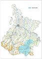
 Aure.jpg 1,212 × 1,653; 714 KB
-
 Bazus-Aure OSM 02.png 817 × 547; 412 KB
-
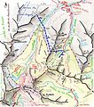 Cartelagelasaux.jpg 729 × 826; 547 KB
-
 FR-65-Pays.png 3,057 × 2,480; 1.45 MB
-
 Périmètre RNR Aulon rnr172.png 1,297 × 818; 685 KB
_2.jpg)


