Category:Maps of Vanves
Jump to navigation
Jump to search
Arrondissement of Antony: Antony · Bagneux · Bourg-la-Reine · Châtenay-Malabry · Châtillon · Clamart · Fontenay-aux-Roses · Malakoff · Le Plessis-Robinson · Sceaux · Montrouge ·
Arrondissement of Boulogne-Billancourt: Boulogne-Billancourt · Chaville · Issy-les-Moulineaux · Marnes-la-Coquette · Meudon · Sèvres · Vanves · Ville-d'Avray ·
Arrondissement of Nanterre: Asnières-sur-Seine · Bois-Colombes · Clichy · Colombes · Courbevoie · Garches · La Garenne-Colombes · Gennevilliers · Levallois-Perret · Nanterre · Neuilly-sur-Seine · Puteaux · Rueil-Malmaison · Saint-Cloud · Suresnes · Vaucresson · Villeneuve-la-Garenne ·
Wikimedia category | |||||
| Upload media | |||||
| Instance of | |||||
|---|---|---|---|---|---|
| Category combines topics | |||||
| Vanves | |||||
commune in Hauts-de-Seine, France     | |||||
| Instance of | |||||
| Location |
| ||||
| Head of government | |||||
| Population |
| ||||
| Area |
| ||||
| Elevation above sea level |
| ||||
| official website | |||||
 | |||||
Media in category "Maps of Vanves"
The following 8 files are in this category, out of 8 total.
-
 1882 Andriveau-Goujon Pocket Map of Paris, France - Geographicus - Paris-andriveau-1882.jpg 6,000 × 4,570; 10.58 MB
-
 92075-Vanves-Hydro.jpeg 5,846 × 4,133; 3.61 MB
-
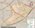 92075-Vanves-Sols.png 3,270 × 2,598; 6.05 MB
-
 Carte postale - Vanves - (Plan de Vanves) - 9FI-VAN 90.jpg 3,590 × 2,420; 1.03 MB
-
 Emprise du château d'issy au milieu du XVIIe siècle.JPG 3,272 × 2,264; 2.38 MB
-
 Map commune FR insee code 92075.png 756 × 605; 52 KB
-

-
 Vanves map.svg 1,552 × 1,586; 541 KB


_-_9FI-VAN_90.jpg)


_dans_son_EPT_du_Grand_Paris_Seine_Ouest_au_sein_de_la_M%C3%A9tropole_du_Grand_Paris.png)