Category:Maps of Velanne
Jump to navigation
Jump to search
Wikimedia category | |||||
| Upload media | |||||
| Instance of | |||||
|---|---|---|---|---|---|
| Category combines topics | |||||
| Velanne | |||||
commune in Isère, France   | |||||
| Instance of | |||||
| Location |
| ||||
| Population |
| ||||
| Area |
| ||||
| official website | |||||
 | |||||
Media in category "Maps of Velanne"
The following 7 files are in this category, out of 7 total.
-
 38531-Velanne - Localisation.png 2,480 × 2,480; 1.24 MB
-
 38531-Velanne-Cadastre.png 7,015 × 4,960; 7.7 MB
-
 38531-Velanne-Hydro.jpeg 5,846 × 4,133; 1.63 MB
-
 38531-Velanne-Hydro.png 7,015 × 4,960; 4.5 MB
-
 38531-Velanne-Sols.png 3,270 × 2,598; 2.04 MB
-
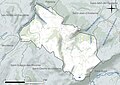
 Géographie Velanne.png 700 × 500; 111 KB
-
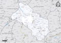
 Map commune FR insee code 38531.png 756 × 605; 47 KB


