Category:Maps of Villelongue-dels-Monts
Jump to navigation
Jump to search
Wikimedia category | |||||
| Upload media | |||||
| Instance of | |||||
|---|---|---|---|---|---|
| Category combines topics | |||||
| Villelongue-dels-Monts | |||||
commune in Pyrénées-Orientales, France  Carrer de Vilallonga dels Monts   | |||||
| Pronunciation audio | |||||
| Instance of | |||||
| Location |
| ||||
| Head of government |
| ||||
| Population |
| ||||
| Area |
| ||||
| official website | |||||
 | |||||
Media in category "Maps of Villelongue-dels-Monts"
The following 5 files are in this category, out of 5 total.
-
 66225-Villelongue-dels-Monts-argile.png 4,076 × 3,307; 5.72 MB
-
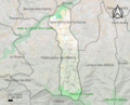
 66225-Villelongue-dels-Monts-Natura2000.png 5,846 × 4,133; 14.91 MB
-
 66225-Villelongue-dels-Monts-ZNIEFF1.png 3,057 × 2,480; 7.04 MB
-
 66225-Villelongue-dels-Monts-ZNIEFF2.png 3,519 × 2,480; 7.73 MB
-
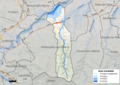 66225-Villelongue-dels-Monts-Zone inondable.png 4,677 × 3,307; 8.69 MB


