Category:Maps of Villossanges
Jump to navigation
Jump to search
Wikimedia category | |||||
| Upload media | |||||
| Instance of | |||||
|---|---|---|---|---|---|
| Category combines topics | |||||
| Villosanges | |||||
commune in Puy-de-Dôme, France _Villossanges_(63380).jpg) .svg)  | |||||
| Instance of | |||||
| Location |
| ||||
| Street address |
| ||||
| Population |
| ||||
| Area |
| ||||
| Elevation above sea level |
| ||||
| official website | |||||
 | |||||
Media in category "Maps of Villossanges"
The following 3 files are in this category, out of 3 total.
-
 63460-Villossanges-Hydro.jpeg 5,846 × 4,133; 2.32 MB
-
 63460-Villossanges-Sols.png 3,270 × 2,598; 2.16 MB
-
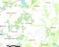 Map commune FR insee code 63460.png 756 × 605; 52 KB

