Category:Maps of Vilnius by Braun & Hogenberg
Jump to navigation
Jump to search
English: maps in this category that were not made by Braun & Hogenberg directly, were made by copying their map design
Media in category "Maps of Vilnius by Braun & Hogenberg"
The following 13 files are in this category, out of 13 total.
-
 Vilnia. Вільня (1576, 1581).jpg 1,902 × 1,391; 1.16 MB
-
 Vilnia. Вільня (1719).jpg 978 × 1,165; 346 KB
-
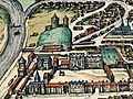
 Civitates orbis terrarum, 1581. Vilna. 27 die dir garde.jpg 490 × 365; 170 KB
-
 Map of Vilnius by Jan Janssonius.jpg 3,854 × 2,897; 2.17 MB
-
 Vilna Lituaniae metropolis - btv1b53178841j (1 of 2).jpg 6,468 × 4,988; 5.93 MB
-
 Vilna Lituaniae metropolis - btv1b532358136 (2 of 3).jpg 11,626 × 8,402; 18.7 MB
-
 Vilnia. Вільня (1659).jpg 4,000 × 3,420; 8.11 MB
-
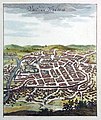
 Vilnia. Вільня (1729).jpg 1,256 × 961; 419 KB
-
 Vilnia. Вільня (1576, 1599).jpg 3,500 × 2,564; 3.59 MB
-
 Vilnius 1576.jpg 2,667 × 1,973; 1.76 MB
-
 Wilno Zamek Gorny i Dolny 1581.jpg 466 × 351; 76 KB
-

-
 Vrbivm praecipvarvm totivs Mvndi liber tertivs 1616 (34065617).jpg 14,337 × 10,062; 26.17 MB
.jpg)
.jpg)


.jpg)
.jpg)
.jpg)
.jpg)
.jpg)


.jpg)
.jpg)