Category:Maps of Vitray-en-Beauce
Jump to navigation
Jump to search
Wikimedia category | |||||
| Upload media | |||||
| Instance of | |||||
|---|---|---|---|---|---|
| Category combines topics | |||||
| Vitray-en-Beauce | |||||
commune in Eure-et-Loir, France   | |||||
| Instance of | |||||
| Location |
| ||||
| Street address |
| ||||
| Population |
| ||||
| Area |
| ||||
 | |||||
Media in category "Maps of Vitray-en-Beauce"
The following 5 files are in this category, out of 5 total.
-
 28419-Vitray-en-Beauce-argile.png 3,057 × 2,480; 1.18 MB
-
 28419-Vitray-en-Beauce-Hydro.jpeg 5,846 × 4,133; 1.17 MB
-
 28419-Vitray-en-Beauce-Sols.png 3,270 × 2,598; 1.18 MB
-
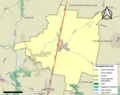
 Map commune FR insee code 28419.png 756 × 605; 25 KB
-
 Vitray-en-Beauce (Eure-et-Loir) dans son Arrondissement.png 2,000 × 2,406; 629 KB


_dans_son_Arrondissement.png)