Category:Maps of West Friesland
Jump to navigation
Jump to search
Wikimedia category | |||||
| Upload media | |||||
| Instance of | |||||
|---|---|---|---|---|---|
| Category combines topics | |||||
| West Friesland | |||||
region in North Holland, Netherlands | |||||
| Instance of | |||||
| Location | North Holland, Netherlands | ||||
| Different from | |||||
 | |||||
Media in category "Maps of West Friesland"
The following 27 files are in this category, out of 27 total.
-
Blaeu 1645 - Hollandiæ pars septentrionalis vulgo Westvriesland en t Noorder Quartier.jpg 3,607 × 3,047; 4.66 MB
-
Comitatus Hollandiae et dominii Ultrajectini tabula - F. de Wit - btv1b53039594n (05 of 16).jpg 11,003 × 7,365; 9.44 MB
-
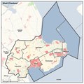
Communes de Frisse occidentale.svg 650 × 450; 145 KB
-
Communes de Frisse occidentale.xcf 618 × 299; 317 KB
-
Drechterland grootslag 1775.svg 665 × 428; 43 KB
-
Hollands Noorderkwartier op het eind der 13e eeuw.jpg 1,051 × 1,244; 741 KB
-
Huygendijk.svg 470 × 266; 221 KB
-
Kaart van West-Friesland - Unknown - 20317237 - RCE.jpg 1,200 × 940; 388 KB
-
Kaart West Frieslandkopie.gif 280 × 503; 12 KB
-
Kaart West-Friesland jan 2019.pdf 1,239 × 1,239; 2.29 MB
-
Kennemerlant ende West-Frieslantt 1683.jpg 4,400 × 3,483; 4.05 MB
-
Kollumerzwaag(Orthelius)-1574-2.jpg 510 × 446; 84 KB
-
West Friesland (historical region).png 294 × 509; 10 KB
-
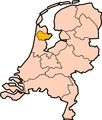
West Friesland-Position.png 200 × 235; 17 KB
-
West-Friesland.png 1,155 × 1,096; 1.33 MB
-
Westfriesland ambachten bannen 1750.svg 1,142 × 599; 216 KB
-
Westfriesland ambachten Drechterland.svg 692 × 407; 146 KB
-
Westfriesland ambachten Geestmerambacht.svg 692 × 407; 145 KB
-
Westfriesland ambachten Schagerenniedorperkoggen.svg 692 × 407; 143 KB
-
Westfriesland ambachten Viernoorderkoggen.svg 692 × 407; 144 KB
-
Westfriesland ambachten VierNoorderKoggen.svg 692 × 407; 140 KB
-
Westfriesland ambachten.svg 692 × 407; 140 KB
-
Westfriesland.png 280 × 503; 15 KB
-
WF historisch.jpg 797 × 980; 137 KB
-
WF samenwerkingsregio.png 294 × 509; 10 KB


