Category:Maps of Wexford County, Michigan
Jump to navigation
Jump to search
Counties of Michigan: Alcona · Alger · Allegan · Alpena · Antrim · Arenac · Baraga · Barry · Bay · Benzie · Berrien · Branch · Calhoun · Cass · Charlevoix · Cheboygan · Chippewa · Clare · Clinton · Crawford · Delta · Dickinson · Eaton · Emmet · Genesee · Gladwin · Gogebic · Grand Traverse · Gratiot · Hillsdale · Houghton · Huron · Ingham · Ionia · Iosco · Iron · Isabella · Jackson · Kalamazoo · Kalkaska · Kent · Keweenaw · Lake · Lapeer · Leelanau · Lenawee · Livingston · Luce · Mackinac · Macomb · Manistee · Marquette · Mason · Mecosta · Menominee · Midland · Missaukee · Monroe · Montcalm · Montmorency · Muskegon · Newaygo · Oakland · Oceana · Ogemaw · Ontonagon · Osceola · Oscoda · Otsego · Ottawa · Presque Isle · Roscommon · Saginaw · Sanilac · Schoolcraft · Shiawassee · St. Clair · St. Joseph · Tuscola · Van Buren · Washtenaw · Wayne · Wexford
Wikimedia category | |||||
| Upload media | |||||
| Instance of | |||||
|---|---|---|---|---|---|
| Category combines topics | |||||
| Wexford County | |||||
county in Michigan, United States   | |||||
| Instance of | |||||
| Named after | |||||
| Location | Michigan | ||||
| Capital | |||||
| Inception |
| ||||
| Population |
| ||||
| Area |
| ||||
| official website | |||||
 | |||||
Subcategories
This category has the following 4 subcategories, out of 4 total.
O
Media in category "Maps of Wexford County, Michigan"
The following 46 files are in this category, out of 46 total.
-

-
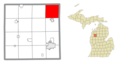
 Antioch Township, MI location.png 1,400 × 750; 124 KB
-
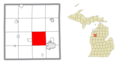
 Boon Township, MI location.png 1,400 × 750; 123 KB
-
 Boon, MI location.png 1,400 × 750; 124 KB
-
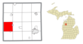
 Buckley, MI location.png 1,400 × 750; 124 KB
-
 Caberfae, MI location.png 1,400 × 750; 124 KB
-
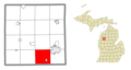
 Cadillac micropolitan statistical area (Michigan).png 1,375 × 750; 216 KB
-
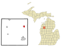
 Cadillac, MI location.png 1,400 × 750; 123 KB
-
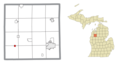
 Cedar Creek Township, Wexford County, MI location.png 1,400 × 750; 123 KB
-
 Cherry Grove Township, MI location.png 1,400 × 750; 123 KB
-
 Clam Lake Township, MI location.png 1,400 × 750; 123 KB
-
 Colfax Township, Wexford County, MI location.png 1,400 × 750; 124 KB
-
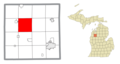
 Greenwood Township, Wexford County, MI location.png 1,400 × 750; 124 KB
-
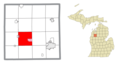
 Hanover Township, Wexford County, MI location.png 1,400 × 750; 123 KB
-
 Haring Charter Township, MI location.png 1,400 × 750; 122 KB
-
 Haring, MI location.png 1,400 × 750; 124 KB
-
 Harrietta, MI location.png 1,400 × 750; 124 KB
-
 Henderson Township, MI location.png 1,400 × 750; 124 KB
-
 Liberty Township, Wexford County, MI location.png 1,400 × 750; 124 KB
-
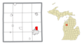
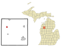
 Manton, MI location.png 1,400 × 750; 124 KB
-
 Map of Michigan highlighting Wexford County.svg 962 × 1,127; 138 KB
-
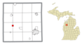
 Mesick, MI location.png 1,400 × 750; 124 KB
-
 Michigan Senate District 35 (2010).png 3,200 × 3,450; 689 KB
-
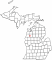
 MIMap-doton-Benson.PNG 261 × 300; 13 KB
-
 MIMap-doton-Boon.PNG 261 × 300; 13 KB
-
 MIMap-doton-Buckley.PNG 261 × 300; 13 KB
-
 MIMap-doton-Cadillac.PNG 261 × 300; 13 KB
-
 MIMap-doton-Harietta.PNG 261 × 300; 13 KB
-
 MIMap-doton-Hoxeyville.PNG 261 × 300; 13 KB
-
 MIMap-doton-Manton.PNG 261 × 300; 13 KB
-
 MIMap-doton-Meauwataka.PNG 261 × 300; 13 KB
-
 MIMap-doton-Mesick.PNG 261 × 300; 13 KB
-
 MIMap-doton-Sherman.PNG 261 × 300; 13 KB
-
 MIMap-doton-Yuma.PNG 261 × 300; 13 KB
-
 Selma Township, MI location.png 1,400 × 750; 124 KB
-
 Slagle Township, MI location.png 1,400 × 750; 124 KB
-
 South Branch Township, Wexford County, MI location.png 1,400 × 750; 124 KB
-
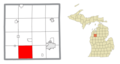
 Springville Township, MI location.png 1,400 × 750; 123 KB
-
 Wedgewood, MI location.png 1,400 × 750; 124 KB
-

-

-

-
-
-
 Wexford County, MI census map.png 750 × 750; 128 KB
-
 Wexford Township, MI location.png 1,400 × 750; 124 KB


.png)


.png)


