Category:Maps of Weymouth and Portland
Jump to navigation
Jump to search
English: Maps of the former Weymouth and Portland district, now in Dorset district, in the ceremonial county of Dorset, England.
Media in category "Maps of Weymouth and Portland"
The following 9 files are in this category, out of 9 total.
-
 DorsetWeymouthPortland.png 200 × 139; 8 KB
-
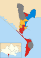 Weymouth and Portland UK local election 2012 map.svg 880 × 1,226; 220 KB
-
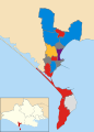 Weymouth and Portland UK local election 2014 map.svg 880 × 1,226; 220 KB
-
 Weymouth and Portland UK local election 2015 map.svg 880 × 1,226; 220 KB
-
 Weymouth and Portland UK local election 2016 map.svg 880 × 1,226; 220 KB
-
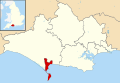 Weymouth and Portland UK locator map.svg 1,425 × 990; 998 KB
-
 Weymouth and Portland UK ward map 2010 (blank).svg 880 × 1,226; 220 KB
-
 Weymouth and Portland wards 2016.png 880 × 1,226; 138 KB
-
 Weymouth unparished area UK locator map.svg 880 × 1,226; 168 KB


.svg)