Category:Maps of Wiehl
Jump to navigation
Jump to search
Wikimedia category | |||||
| Upload media | |||||
| Instance of | |||||
|---|---|---|---|---|---|
| Category combines topics | |||||
| Wiehl | |||||
municipality in the Oberbergischer Kreis, in Northrhine-Westfalia, Germany    | |||||
| Instance of |
| ||||
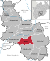
| Location | Oberbergischer Kreis, Cologne Government Region, North Rhine-Westphalia, Germany | ||||
| Head of government |
| ||||
| Population |
| ||||
| Area |
| ||||
| Elevation above sea level |
| ||||
| Different from | |||||
| official website | |||||
 | |||||
Media in category "Maps of Wiehl"
The following 58 files are in this category, out of 58 total.
-
 Belling.B.Gr.JPG 419 × 303; 18 KB
-
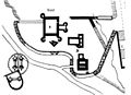
 Flurkarte Scheidt 1808.JPG 1,871 × 3,064; 694 KB
-
 Karte-wiehl.png 1,044 × 597; 327 KB
-
 Lage der Stadt Wiehl in Deutschland.png 188 × 235; 5 KB
-
 OSM-Inselkarte-Wiehl.png 1,108 × 585; 154 KB
-
 Wiehl in GM.svg 389 × 473; 299 KB
-
 Wiehl Karte.png 720 × 726; 135 KB
-
 Wiehl-lage-alferzhagen.png 888 × 620; 256 KB
-
 Wiehl-lage-alpe.png 888 × 620; 254 KB
-
 Wiehl-lage-alperbrück.png 888 × 620; 252 KB
-
 Wiehl-lage-angfurten.png 888 × 620; 251 KB
-
 Wiehl-lage-bieberstein.png 888 × 620; 247 KB
-
 Wiehl-lage-bielstein.png 888 × 620; 253 KB
-
 Wiehl-lage-bomig.png 888 × 620; 253 KB
-
 Wiehl-lage-breidenbruch.png 888 × 620; 258 KB
-
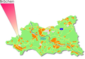 Wiehl-lage-brächen.png 888 × 620; 256 KB
-
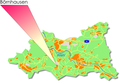 Wiehl-lage-börnhausen.png 888 × 620; 252 KB
-
 Wiehl-lage-büddenhagen.png 888 × 620; 262 KB
-
 Wiehl-lage-büttinghausen.png 888 × 620; 251 KB
-
 Wiehl-lage-dahl.png 888 × 620; 253 KB
-
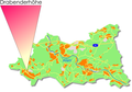 Wiehl-lage-drabenderhöhe.png 888 × 620; 261 KB
-
 Wiehl-lage-dreisbach.png 888 × 620; 254 KB
-
 Wiehl-lage-drosselhardt.png 888 × 620; 253 KB
-
 Wiehl-lage-fahlenbruch.png 888 × 620; 253 KB
-
 Wiehl-lage-faulmert.png 888 × 620; 249 KB
-
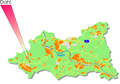
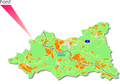 Wiehl-lage-forst.png 887 × 618; 248 KB
-
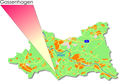 Wiehl-lage-gassenhagen.png 888 × 620; 253 KB
-
 Wiehl-lage-großfischbach.png 888 × 620; 243 KB
-
 Wiehl-lage-hahn.png 888 × 620; 253 KB
-
 Wiehl-lage-hau.png 888 × 618; 253 KB
-
 Wiehl-lage-hengstenberg.png 888 × 620; 250 KB
-
 Wiehl-lage-hillerscheid.png 888 × 620; 255 KB
-
 Wiehl-lage-hübender.png 888 × 620; 243 KB
-
 Wiehl-lage-hückhausen.png 888 × 620; 255 KB
-
 Wiehl-lage-immen.png 888 × 618; 253 KB
-
 Wiehl-lage-jennecken.png 888 × 620; 257 KB
-
 Wiehl-lage-kleinfischbach.png 888 × 620; 239 KB
-
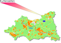 Wiehl-lage-kurtensiefen.png 888 × 620; 256 KB
-
 Wiehl-lage-linden.png 888 × 620; 250 KB
-
 Wiehl-lage-marienhagen.png 888 × 620; 257 KB
-
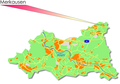 Wiehl-lage-merkausen.png 888 × 620; 256 KB
-
 Wiehl-lage-monsau.png 888 × 618; 255 KB
-
 Wiehl-lage-morkepütz.png 888 × 620; 255 KB
-
 Wiehl-lage-mühlen.png 888 × 620; 247 KB
-
 Wiehl-lage-mühlhausen.png 888 × 620; 256 KB
-
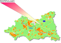
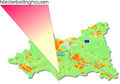 Wiehl-lage-niederbellinghausen.png 888 × 620; 241 KB
-
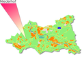 Wiehl-lage-niederhof.png 888 × 620; 256 KB
-
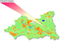 Wiehl-lage-oberholzen.png 888 × 620; 255 KB
-
 Wiehl-lage-oberwiehl.png 888 × 620; 250 KB
-
 Wiehl-lage-pergenroth.png 888 × 620; 257 KB
-
 Wiehl-lage-pfaffenberg.png 888 × 620; 242 KB
-
 Wiehl-lage-remberg.png 888 × 618; 249 KB
-
 Wiehl-lage-siefen.png 888 × 620; 251 KB
-
 Wiehl-lage-steinacker.png 888 × 620; 252 KB
-
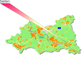
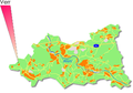 Wiehl-lage-verr.png 888 × 618; 252 KB
-
 Wiehl-lage-wald.png 888 × 620; 254 KB
-
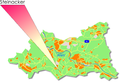
 Wiehl-lage-weiershagen.png 888 × 620; 257 KB
-
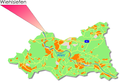 Wiehl-lage-wiehlsiefen.png 888 × 620; 254 KB


