Category:Maps of Zanjan Province
Jump to navigation
Jump to search
- Provinces of Iran
- Alborz
- Ardabil
- Bushehr
- Chaharmahal and Bakhtiari
- East Azerbaijan
- Fars
- Gilan
- Golestan
- Hamadan
- Hormozgan
- Ilam
- Isfahan
- Kerman
- Kermanshah
- Khuzestan
- Kohgiluyeh and Boyer-Ahmad
- Kurdistan
- Lorestan
- Markazi
- Mazandaran
- North Khorasan
- Qazvin
- Qom
- Razavi Khorasan
- Semnan
- Sistan and Baluchestan
- South Khorasan
- Tehran
- West Azerbaijan
- Yazd
- Zanjan
Media in category "Maps of Zanjan Province"
The following 18 files are in this category, out of 18 total.
-
 Abhar Constituency.png 1,000 × 920; 52 KB
-
 Mahneshan Constituency.png 1,000 × 920; 52 KB
-
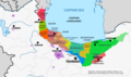 Map of Caspian Languages in Iran and Azerbaijan.png 1,251 × 742; 439 KB
-
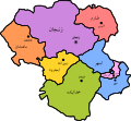
 Okruzi u Zandžanskoj pokrajini.PNG 780 × 750; 33 KB
-
 Qeydar Constituency.png 1,000 × 920; 52 KB
-
 Zandžan (pokrajina).JPG 435 × 400; 23 KB
-
 Zanjan Constituency.png 1,000 × 920; 52 KB
-
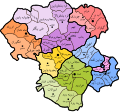
 Zanjan Counties Map.png 3,449 × 3,259; 161 KB
-
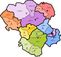
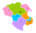
 Zanjan counties.png 1,001 × 874; 29 KB
-
 Zanjan fa.svg 820 × 780; 271 KB
-
 Zanjan Map - Bakhsh.svg 952 × 882; 496 KB
-
 Zanjan Map - Towns.svg 952 × 882; 747 KB
-
 Zanjan Map.svg 952 × 882; 346 KB
-
 Zanjan Province Constituencies.png 1,000 × 920; 51 KB
-
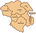
 Zanjan province counties.PNG 879 × 806; 27 KB
-
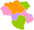
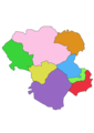
 Zanjan province parts.PNG 879 × 806; 31 KB
-
 Zanjan-province.png 2,480 × 3,508; 190 KB
-
 Zanjan.svg 820 × 780; 286 KB


.JPG)


