Category:Maps of canals
Jump to navigation
Jump to search
Subcategories
This category has the following 8 subcategories, out of 8 total.
C
- Maps of Corinth Canal (22 F)
E
- Maps of the Erie Canal (3 P, 25 F)
O
- Maps of the Canal de Ofqui (9 F)
P
S
Media in category "Maps of canals"
The following 32 files are in this category, out of 32 total.
-
 Ben Gurion Canal compared to Suez Canal.webp 1,055 × 973; 852 KB
-
 Canal d'Urgell - Plànol General 1890.jpg 12,000 × 12,000; 27.63 MB
-
 Canal proposed by Pliny the Younger. Reconstruction attempt from 1818.jpg 2,000 × 1,232; 886 KB
-
 Canale Danubio-Mar Nero.jpg 315 × 291; 91 KB
-
 Constanta-Rotterdam blank-he.svg 512 × 217; 38 KB
-
 Constanta-Rotterdam blank.png 894 × 377; 29 KB
-
 Constanta-Rotterdam blank.svg 512 × 217; 39 KB
-
 Constanta-Rotterdam DE.PNG 894 × 377; 32 KB
-
 Constanta-Rotterdam eo.png 894 × 377; 42 KB
-
 Danube-Black Sea Canal.png 315 × 291; 12 KB
-
 Early Islamic watercourses and settlements east of the Tigris.png 1,602 × 1,824; 95 KB
-
 Farmers of forty centuries - Map of country surrounding Shanghai, China.jpg 1,368 × 1,599; 785 KB
-
 HQL Plan 3C.jpg 1,772 × 1,064; 381 KB
-
 HQL Plan 4C.svg 1,140 × 655; 289 KB
-
 Iranrood.png 1,400 × 1,291; 3 MB
-
 Kanal MK1888.png 747 × 459; 105 KB
-
 Kanalo Danubo-Nigra Maro.png 315 × 291; 20 KB
-
 Map of the South–North Water Transfer Project in China (blank).png 2,340 × 1,199; 362 KB
-
 Map of the South–North Water Transfer Project in China (de).png 2,340 × 1,199; 646 KB
-
 Nevezio kanalas.png 1,570 × 1,224; 414 KB
-
 Nyköpings kanal.svg 744 × 673; 2.5 MB
-
 Pilppa.svg 614 × 699; 44 KB
-
 Regent's Canal map.jpg 1,453 × 789; 1.52 MB
-
 Salem Beverly Waterway Canal - USGS map (1 July 1985).jpg 1,000 × 800; 294 KB
-
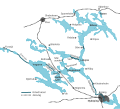
 Trent-Severn Waterway map.jpg 3,620 × 2,563; 3.42 MB
-
 VilhelmoKanalas.png 1,422 × 1,239; 497 KB
-
 Volga-Baltic Waterway.PNG 309 × 266; 189 KB
-
 Volga-BalticWaterway.png 589 × 499; 259 KB
-
 Wagenfuhrer 1900 Vienna Adriatic Sea canal.jpg 871 × 620; 93 KB
-
 Welland Canal - First Canal Stage One.png 473 × 416; 36 KB
-
 XWrNeustadt 1880.jpg 1,980 × 1,709; 1.08 MB
-
 Е40 waterway map.png 762 × 553; 217 KB


.jpg)


.png)
.png)