Category:Maps of counties of Denmark from Frems Amtskort over Danmark (c. 1897–1904)
Jump to navigation
Jump to search
Maps from Frem.; Generalstabens Topografiske Afdeling ([1897–1904?]) Frems Amtskort over Danmark: I 26 Blade i Størrelse 1:200 000 samt 73 Byplaner, [Copenhagen]: Gyldendalske Boghandel, Nordisk Forlag; Det Nordiske Forlag OCLC: 475400818.
Pages in category "Maps of counties of Denmark from Frems Amtskort over Danmark (c. 1897–1904)"
This category contains only the following page.
Media in category "Maps of counties of Denmark from Frems Amtskort over Danmark (c. 1897–1904)"
The following 200 files are in this category, out of 200 total.
-
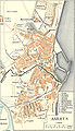 -Aarhus 1900.jpg 1,352 × 2,356; 1.97 MB
-
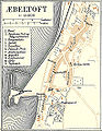 -Ebeltoft 1900.jpg 823 × 1,058; 513 KB
-
 -Endelave1900.jpg 468 × 383; 180 KB
-
 -Enoe.jpg 524 × 467; 260 KB
-
 -Fredericia 1900.jpg 1,511 × 1,388; 1.67 MB
-
 -GaltenHerred1900.jpg 1,442 × 1,337; 1.24 MB
-
 -GjerlevHerred1900.jpg 1,274 × 1,141; 1.13 MB
-
 -GjernHerred1900.jpg 1,781 × 1,757; 1.91 MB
-
 -Grenaa 1900.jpg 965 × 831; 522 KB
-
 -Hillerød 1900.jpg 1,618 × 1,311; 1.06 MB
-
 -Hjelmslev Herred1900.jpg 1,550 × 1,094; 1.47 MB
-
 -Hobro 1900.jpg 1,139 × 1,033; 785 KB
-
 -Horsen 1900.jpg 1,607 × 1,532; 1.41 MB
-
 -ImageNakskov Fjord.jpg 741 × 719; 445 KB
-
 -ImageRoenne 1900 - place marked where Johan Printzensköld was murdered.jpg 1,011 × 1,210; 192 KB
-
 -ImageRoenne 1900.jpg 1,011 × 1,210; 914 KB
-
 -Kalundborg 1900.jpg 1,382 × 782; 695 KB
-
 -Kolding1900.jpg 1,139 × 1,245; 951 KB
-
 -korsoer.jpg 814 × 1,648; 989 KB
-
 -Læsoe omkring 1900.jpg 1,493 × 1,187; 1.42 MB
-
 -Mariager 1900.jpg 771 × 955; 417 KB
-
 -Maribo 1900.jpg 889 × 702; 469 KB
-
 -Nakskov 1900.jpg 1,399 × 874; 759 KB
-
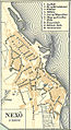 -Nexoe 1900.jpg 671 × 1,230; 618 KB
-
 -NimHerred1900.jpg 1,375 × 1,056; 1.16 MB
-
 -NoerhaldHerred1900.jpg 1,922 × 831; 1.04 MB
-
 -Nykøbing Mors 1900.jpg 945 × 956; 611 KB
-
 -Nykøbingfalster 1900.jpg 1,071 × 1,064; 742 KB
-
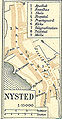 -Nysted 1900.jpg 430 × 824; 211 KB
-
 -OnsildHerred1900.jpg 2,024 × 1,083; 1.31 MB
-
 -Randers 1900.jpg 2,029 × 2,067; 2.51 MB
-
 -Ringsted.jpg 793 × 1,139; 598 KB
-
 -Roedby 1900.jpg 872 × 465; 237 KB
-
 -Roskilde 1900.jpg 1,046 × 897; 657 KB
-
 -RougsoeHerred1900.jpg 937 × 1,080; 793 KB
-
 -Sakskoebing 1900.jpg 610 × 615; 226 KB
-
 -Saltbaek Vig.jpg 885 × 599; 450 KB
-
 -Silkeborg 1900.jpg 1,481 × 769; 877 KB
-
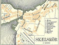 -Skaelskør.jpg 899 × 686; 540 KB
-
 -Skanderborg 1900.jpg 733 × 1,250; 634 KB
-
 -Skanderborg Sø1900.jpg 587 × 475; 276 KB
-
 -skive 1900.jpg 1,064 × 1,075; 657 KB
-
 -Skive Fjord.jpg 828 × 1,080; 708 KB
-
 -slagelse.jpg 1,133 × 1,026; 823 KB
-
 -Soenderhald Herred1900.jpg 2,141 × 1,479; 2.21 MB
-
 -StoevringHerred1900.jpg 1,370 × 616; 606 KB
-
 -Stubbekoebing 1900.jpg 829 × 592; 287 KB
-
 -Svaneke 1900.jpg 581 × 877; 355 KB
-
 -Thisted 1900.jpg 1,056 × 963; 730 KB
-
 -Tyrsting Herred 1900.jpg 1,656 × 1,507; 2.02 MB
-
 -Vejle1900.jpg 1,158 × 1,238; 1.16 MB
-
 -Viborg 1900.jpg 1,430 × 1,167; 1.1 MB
-
 -VoerHerred1900.jpg 1,475 × 1,332; 1.72 MB
-
 Aakirkeby 1900 (cropped).jpg 657 × 514; 260 KB
-
 Aarhus Amt.jpg 4,616 × 5,456; 10.84 MB
-
 Aars Herred Aalborg Amt (cropped).jpg 2,405 × 1,933; 2.72 MB
-
 Aeroeskoebing 1900.jpg 569 × 689; 399 KB
-
 Ageersoe omoe.jpg 864 × 863; 742 KB
-
 Agger Tange ca 1900.jpg 768 × 678; 604 KB
-
 Allinge 1900 (cropped).jpg 574 × 836; 418 KB
-
 Assens 1900.jpg 858 × 889; 739 KB
-
 Avnoe fjord.jpg 1,071 × 810; 793 KB
-
 BegtrupVig.jpg 980 × 876; 900 KB
-
 Bjerre Herred-Vejle Amt1900.jpg 1,497 × 1,467; 2.16 MB
-
 Bjoernsholm bugt.jpg 759 × 767; 622 KB
-
 Bogense 1900.jpg 825 × 663; 510 KB
-
 Bornholm 1900.jpg 4,183 × 5,359; 13.43 MB
-
 BregnetSogn.jpg 572 × 392; 247 KB
-
 Brusk Herred-Vejle Amt1900.jpg 1,331 × 1,191; 1.46 MB
-
 Bølling Herred-Ringkøbing Amt syd.jpg 2,269 × 1,992; 3.62 MB
-
 Børglum Herred Aalborg Amt (cropped).jpg 2,152 × 1,703; 2.1 MB
-
 Djurs SoenderHerred1900.jpg 2,004 × 1,264; 1.71 MB
-
 DjursNoerreHerred1900.jpg 1,760 × 1,248; 1.56 MB
-
 Draaby Vig.jpg 497 × 459; 264 KB
-
 Dragstrup Vig.jpg 843 × 550; 328 KB
-
 Dronningborg Herred-Hjoerring Amt (cropped).jpg 2,212 × 1,512; 1.89 MB
-
 Elbo Herred-Vejle Amt1900.jpg 1,324 × 938; 1.21 MB
-
 Ertholmene.jpg 399 × 232; 196 KB
-
 Esbjerg 1900.jpg 1,879 × 1,265; 1.73 MB
-
 Faaborg 1900.jpg 938 × 593; 590 KB
-
 Faenoe map.jpg 333 × 425; 234 KB
-
 Fering Soe (cropped).jpg 887 × 668; 550 KB
-
 Fjends Herred-Viborg Amt nordvest.jpg 1,446 × 2,326; 2.71 MB
-
 Fleskum Herred1900.jpg 1,909 × 1,941; 2.06 MB
-
 Frederikshavn o1900.jpg 1,361 × 1,743; 1.67 MB
-
 Frederiksvaerk 1900.jpg 947 × 805; 502 KB
-
 Gamborg Fjord 1900.jpg 747 × 707; 608 KB
-
 Ginding Herred-Ringkøbing Amt .jpg 1,966 × 2,252; 3.11 MB
-
 Ginding Herred-Ringkøbing Amt.jpg 1,924 × 2,202; 3 MB
-
 Gislum Herred Aalborg Amt(cropped).jpg 2,365 × 1,437; 1.98 MB
-
 Hammerhus mm.jpg 921 × 757; 577 KB
-
 Hammerum Herred-Ringkøbing Amt syd.jpg 2,998 × 3,640; 6.16 MB
-
 Harre Herred-Viborg Amt nordvest.jpg 1,189 × 1,246; 1.36 MB
-
 Hasle Bornholm 1900 (cropped).jpg 592 × 830; 437 KB
-
 Hatting Herred-Vejle Amt1900.jpg 1,347 × 1,403; 1.74 MB
-
 Hellum Herred Aalborg Amt (cropped).jpg 1,713 × 1,323; 1.65 MB
-
 Helsingoer 1900.jpg 1,232 × 1,388; 1.07 MB
-
 Hids Herred Viborg Amt oest.jpg 1,677 × 1,136; 1.57 MB
-
 Hind Herred -Ringkøbing Amt syd.jpg 2,367 × 3,239; 6.8 MB
-
 Hind Herred-Ringkøbing Amt syd.jpg 2,187 × 3,337; 6.56 MB
-
 Hindborg Herred ViborgAmt.jpg 857 × 938; 739 KB
-
 Hindsted Herred - Aalborg Amt (cropped).jpg 2,564 × 1,493; 2.23 MB
-
 Hjoerring og Aalborg Amter III.jpg 5,570 × 4,696; 12.44 MB
-
 Hjoerring og Aalborg Amter IV.jpg 5,160 × 4,320; 10.74 MB
-
 Hjoerring og Aalborg Amter.jpg 5,592 × 4,456; 15.65 MB
-
 Hjorring o1900.jpg 1,143 × 973; 869 KB
-
 Hjortoe.jpg 842 × 521; 494 KB
-
 HoBugt.jpg 1,197 × 1,227; 1.44 MB
-
 Holbaek 1900.jpg 1,417 × 1,039; 963 KB
-
 Holbaek Amt 2.jpg 4,724 × 5,315; 10.49 MB
-
 Holbaek Amt.jpg 4,157 × 5,394; 10.88 MB
-
 Holbjerg Herred-Viborg Amt oest.jpg 2,002 × 1,506; 2.43 MB
-
 Holmans Herred-Vejle Amt1900 ().jpg 1,087 × 1,064; 1.14 MB
-
 Holstebro 1900.jpg 898 × 1,269; 758 KB
-
 Horns Herred-Hjoerring Amt (cropped).jpg 1,981 × 2,619; 2.53 MB
-
 Hornum Herred Aalborg Amt (cropped).jpg 1,566 × 1,941; 1.85 MB
-
 Houlbjerg Herred Viborg Amt oest.jpg 1,562 × 1,046; 1.32 MB
-
 Jerlev Herred-Vejle Amt1900.jpg 1,505 × 1,017; 1.35 MB
-
 Jordbro aa.jpg 786 × 1,057; 491 KB
-
 Karrebaek Fjord.jpg 510 × 545; 288 KB
-
 Kerteminde 1900.jpg 1,122 × 585; 675 KB
-
 Kilen.jpg 349 × 264; 123 KB
-
 Knebel VIg.jpg 526 × 487; 289 KB
-
 Koebenhavnsamt.jpg 4,986 × 4,500; 11.42 MB
-
 Koebenhavnsamt2.jpg 4,945 × 4,299; 11.43 MB
-
 Koege 1900.jpg 1,250 × 854; 636 KB
-
 Kær Herred Aalborg Amt (cropped).jpg 2,644 × 1,413; 2.17 MB
-
 Lemvig 1900.jpg 1,140 × 613; 485 KB
-
 Lindelse Nor.jpg 609 × 609; 483 KB
-
 Lolland-Falster.jpg 5,232 × 4,423; 14.02 MB
-
 LounsBredningmm.jpg 1,554 × 1,441; 1.92 MB
-
 Map - Moens Klint.jpg 415 × 601; 313 KB
-
 Map of Frederikssund in Frederiksborg Counties in Denmark ca. 1900.jpg 876 × 854; 359 KB
-
 Marstal 1900.jpg 689 × 673; 501 KB
-
 Middelfart 1900.jpg 1,038 × 648; 584 KB
-
 Middelsom Herred-Viborg Amt oest.jpg 2,532 × 1,104; 2.17 MB
-
 MolsHerred1900.jpg 1,984 × 1,320; 2.11 MB
-
 Naestved 1900.jpg 980 × 1,233; 760 KB
-
 Nissum Bredning.jpg 2,016 × 1,768; 2.48 MB
-
 Nissumbredningmm.jpg 1,821 × 1,543; 3.03 MB
-
 Nordsamsoe.jpg 1,478 × 871; 942 KB
-
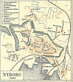 Nyborg 1900.jpg 1,031 × 1,157; 982 KB
-
 Nyborg Fjord.jpg 590 × 385; 455 KB
-
 Nykoebing Sjaelland 1900.jpg 931 × 715; 428 KB
-
 Nørlyng Herred-Viborg Amt oest.jpg 2,098 × 1,576; 2.76 MB
-
 Nørre Herred-Viborg Amt nordvest.jpg 963 × 1,429; 1.28 MB
-
 Nørre Tyrstrup Herred-Vejle Amt1900.jpg 1,607 × 978; 1.43 MB
-
 Nørvang Herred-Vejle Amt1900.jpg 3,285 × 2,105; 4.88 MB
-
 Odense 1900.jpg 1,659 × 2,115; 3.19 MB
-
 Odense Amt.jpg 5,154 × 4,789; 16.27 MB
-
 OesterLisbjergHerred1900.jpg 1,593 × 1,248; 1.46 MB
-
 Praestoe 1900.jpg 987 × 726; 551 KB
-
 Praestoe Amt.jpg 4,934 × 4,136; 11.39 MB
-
 Randers 1900 detail Tøjhushavekvarteret.png 550 × 581; 760 KB
-
 Randers Amt east.jpg 4,616 × 5,528; 10.51 MB
-
 Randers Amt vest.jpg 4,544 × 5,316; 12.04 MB
-
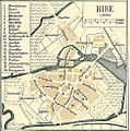 Ribe 1900.jpg 969 × 981; 719 KB
-
 RibeAmt oest.jpg 4,299 × 4,975; 12.97 MB
-
 RibeAmt vest.jpg 4,188 × 5,015; 12.87 MB
-
 Rinds Herred-Viborg Amt oest.jpg 1,684 × 1,703; 2.27 MB
-
 Ringkoebing 1900.jpg 894 × 849; 593 KB
-
 Ringkøbing Amt syd.jpg 5,260 × 4,269; 13.8 MB
-
 Ringkøbing Amt.jpg 4,987 × 4,127; 11.94 MB
-
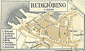 Rudkoebing 1900.jpg 866 × 529; 509 KB
-
 Rødby fjord.png 871 × 630; 1.29 MB
-
 Rødding Herred -Viborg Amt nordvest.jpg 1,051 × 1,177; 1.14 MB
-
 Saeby o1900.jpg 1,312 × 737; 691 KB
-
 SallingViborgAmt.jpg 2,007 × 2,077; 3.56 MB
-
 Samsoe.jpg 1,848 × 1,904; 1.7 MB
-
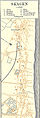 Skagen o1900.jpg 656 × 1,939; 763 KB
-
 Skanderborg Amt.jpg 4,374 × 5,301; 11.76 MB
-
 Skodborg Herred-Ringkøbing Amt.jpg 2,123 × 1,832; 3.51 MB
-
 Skovvejen 1900.jpg 2,798 × 468; 1.63 MB
-
 Slet Herred Aalborg Amt (cropped).jpg 1,742 × 1,270; 1.35 MB
-
 Soende LemVig.jpg 527 × 421; 221 KB
-
 Soroe Amt.jpg 4,956 × 4,075; 12.07 MB
-
 Sorø ca 1900.jpg 758 × 941; 609 KB
-
 St. Heddinge 1900.jpg 606 × 951; 383 KB
-
 Stavns Fjord.jpg 778 × 678; 917 KB
-
 Stege 1900.jpg 726 × 810; 455 KB
-
 Svendborg 1900.jpg 1,104 × 1,208; 1.13 MB
-
 Svendborg Amt.jpg 5,611 × 4,774; 18.37 MB
-
 Sønderlyng Herred-Viborg Amt oest.jpg 2,073 × 1,040; 1.67 MB
-
 Thisted Amt.jpg 5,268 × 4,246; 14.77 MB
-
 Thisted Bredning .jpg 1,264 × 1,046; 1.34 MB
-
 Thuroe.jpg 437 × 325; 224 KB
-
 Tørrild Herred-Vejle Amt1900.jpg 1,718 × 1,293; 1.94 MB
-
 Ulfborg Herred-Ringkøbing Amt.jpg 2,458 × 1,002; 1.76 MB
-
 Vaerslevbanen.jpg 769 × 1,932; 714 KB
-
 Varde 1900.jpg 646 × 862; 437 KB
-
 Vejle Amt1900.jpg 5,515 × 4,581; 15.49 MB
-
 Vejlerne Thisted Amt (cropped).jpg 1,430 × 1,453; 1.99 MB
-
 Vennebjerg Herred-Hjoerring Amt (cropped).jpg 1,990 × 1,629; 1.79 MB
-
 Venoe bugt.jpg 1,047 × 1,105; 1.02 MB
-
 Vestlige Vejler Thisted Amt (cropped).jpg 918 × 753; 706 KB
-
 Viborg Amt nordvest.jpg 4,404 × 5,230; 13.33 MB
-
 Viborg Amt oest.jpg 4,464 × 5,270; 12.52 MB
-
 Vordingborg 1900.jpg 1,198 × 895; 679 KB
-
 VradsHerred1900.jpg 2,028 × 2,535; 2.89 MB
-
 Øster Han Herred-Aalborg Amt (cropped).jpg 2,125 × 1,270; 1.6 MB


.jpg)

.jpg)


.jpg)


.jpg)


.jpg)


.jpg)


.jpg)


.jpg)

.jpg)


.jpg)


.jpg)

.jpg)
.jpg)


.jpg)


.jpg)


.jpg)
.jpg)

.jpg)


.jpg)