Category:Old maps of Denmark
Jump to navigation
Jump to search
Use the appropriate category for maps showing all or a large part of Denmark. See subcategories for smaller areas:
| If the map shows | Category to use |
|---|---|
| Denmark on a recently created map | Category:Maps of Denmark or its subcategories |
| Denmark on a map created more than 70 years ago | Category:Old maps of Denmark or its subcategories |
| the history of Denmark on a recently created map | Category:Maps showing history of Denmark or its subcategories |
| the history of Denmark on a map created more than 70 years ago | Category:Old maps of the history of Denmark or its subcategories |
Subcategories
This category has the following 20 subcategories, out of 20 total.
.
- Old Danish nautical charts (2 F)
C
E
F
H
O
- Old maps of Bornholm (25 F)
- Old maps of Ribe (5 F)
P
S
Ö
Media in category "Old maps of Denmark"
The following 43 files are in this category, out of 43 total.
-

-

-

-
 255 of 'Invasion du Danemark en 1864' (11069399545).jpg 4,890 × 3,941; 3.32 MB
-
 260 of 'Illustreret Danmarkshistorie for Folket, etc' (11043631663).jpg 1,649 × 1,495; 403 KB
-

-
 303 of 'Lærebog i Nordens Historie ... Med 10 ... Kort, etc' (11302782355).jpg 1,357 × 1,475; 437 KB
-
 327 of 'Felttogene, 1848, 49, 50' (11037919595).jpg 1,509 × 2,479; 831 KB
-
 503 of 'Den anden slesvigske Krig. (With maps.)' (11165198643).jpg 2,982 × 2,249; 1.21 MB
-
 528 of 'Illustreret Danmarkshistorie for Folket, etc' (11020825025).jpg 1,238 × 808; 225 KB
-
 599 of 'Illustreret Danmarkshistorie for Folket, etc' (11019579723).jpg 828 × 795; 147 KB
-
 61 of 'Invasion du Danemark en 1864' (11069418416).jpg 1,494 × 3,951; 1.12 MB
-
 A new system of geography- or, a general description of the world Fleuron T133336-2.png 2,031 × 2,024; 214 KB
-

-
 Admiralty Chart Catalogue 1967 Page 024 Index D.jpg 8,595 × 6,929; 9.32 MB
-
 Admiralty Chart No 1938 Alsen Sund and Augustenburger Forde, Published 1910.jpg 10,884 × 16,149; 78.81 MB
-
 Admiralty Chart No 2116 Great and Little Belts, Published 1852, Large Corrections 1901.jpg 15,942 × 10,910; 72.33 MB
-
 Admiralty Chart No 2842a Baltic Sea Western Sheet, Published 1862, Large Corrections 1927.jpg 11,052 × 16,270; 71.5 MB
-
 Admiralty Chart No 598 Limfjord Hals to Logstor, Published 1965.jpg 16,399 × 11,279; 39.54 MB
-
 Botanisk tidsskrift (1914) (19784017483).jpg 3,952 × 2,604; 1.58 MB
-
 Botanisk tidsskrift (1914) (20378661276).jpg 2,830 × 1,788; 704 KB
-
 Botanisk tidsskrift (1914) (20404907085).jpg 2,700 × 4,361; 1.17 MB
-
 Botanisk tidsskrift (1916) (20217978928).jpg 2,300 × 4,068; 1.12 MB
-
 Dansk ornithologisk forenings tidsskrift (1914) (20837445955).jpg 2,080 × 2,988; 1.48 MB
-
 Dansk ornithologisk forenings tidsskrift (1917) (20844450581).jpg 1,922 × 2,922; 892 KB
-
-
 Folkevennen 1864 - Dansk Sprogkaart.png 1,180 × 1,332; 49 KB
-
 Folkevennen 1864 - Kart over Sønderjylland.png 2,864 × 2,665; 487 KB
-
 Folkevennen 1864 - Tysk Sprogkaart.png 1,155 × 1,335; 51 KB
-

-
 Kaart over Slaget ved Kjöge, den 29de August 1807.jpg 2,224 × 2,532; 716 KB
-
 Kart over Jernbaner i Norge, Sverige og Danmark. 10de oplag - btv1b8445664q.jpg 7,104 × 9,419; 9.72 MB
-

-

-
 Oversigtskort til Krigsbegivenhederne i Sjælland Aaret 1807.jpg 2,590 × 3,234; 953 KB
-
 Qvistgaard map detail 1816.png 719 × 966; 1.37 MB
-
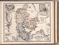
 Stieler 1867 Atlas page Danmark with insets (Greenland cropped).jpg 1,267 × 1,939; 1.19 MB
-
 Stieler 1867 Atlas page Danmark with insets.jpg 9,804 × 7,522; 25.66 MB
-
 The earth and its inhabitants (1883) (20941160678).jpg 1,824 × 1,726; 865 KB
-
-
 Tondern1651.jpg 2,996 × 1,906; 4.3 MB
-
 Trelleborg-paa-manzas-kort-fra-1839.png 700 × 448; 758 KB
-

.jpg)
%27_(11185617214).jpg)
%27_(11183561473).jpg)
.jpg)
.jpg)
.jpg)
.jpg)
.jpg)
%27_(11165198643).jpg)
.jpg)
.jpg)

_(14586432698).jpg)


_(19784017483).jpg)
_(20378661276).jpg)
_(20404907085).jpg)
_(20217978928).jpg)
_(20837445955).jpg)
_(20844450581).jpg)
.jpg)


_(14592179367).jpg)
_(14592979927).jpg)


.jpg)

_(20941160678).jpg)
_(14582613208).jpg)


.jpg)
.jpg)