Category:Maps of deforestation
Jump to navigation
Jump to search
Subcategories
This category has the following 2 subcategories, out of 2 total.
W
- World maps of deforestation (37 F)
Media in category "Maps of deforestation"
The following 7 files are in this category, out of 7 total.
-
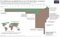 Long-term-forest-loss-–-Marimekko.png 1,974 × 1,222; 228 KB
-
 Deforestationcloudcover.jpg 353 × 301; 81 KB
-
 Deforestationtemp.jpg 367 × 303; 76 KB
-
 ECDM 20230508 WF Amazonia fires.pdf 1,625 × 1,125; 616 KB
-
 FISHER(1888) p38 - Forest of Essex, Disafforestation and Boundaries in 1225.jpg 2,496 × 1,861; 672 KB
-
 Infografia monitoreo bn 2018 page-0001.jpg 1,241 × 1,754; 1.04 MB
-
 Screenshot of Our World in Data Map.png 1,456 × 960; 287 KB


_p38_-_Forest_of_Essex,_Disafforestation_and_Boundaries_in_1225.jpg)

