Category:Maps of districts of Khyber Pakhtunkhwa
Jump to navigation
Jump to search
Provinces of Pakistan: Khyber Pakhtunkhwa · Punjab · Sindh ·
Territories: Azad Kashmir · Gilgit-Baltistan ·
Territories: Azad Kashmir · Gilgit-Baltistan ·
Subcategories
This category has the following 2 subcategories, out of 2 total.
A
- Abbottabad District maps (22 F)
Media in category "Maps of districts of Khyber Pakhtunkhwa"
The following 47 files are in this category, out of 47 total.
-
Blank map of the districts of Khyber Pakhtunkhwa, Pakistan.png 3,840 × 3,840; 1.24 MB
-
Khyber Pakhtunkhwa Districts Names.svg 2,682 × 4,166; 487 KB
-
Abbottabad District.png 1,731 × 1,788; 2.03 MB
-
Abbottabad Tehsil.png 1,731 × 1,788; 1.92 MB
-
Bajaur District Tehsils.png 2,296 × 1,733; 1.92 MB
-
Baka Khel Tehsil.png 2,167 × 1,715; 1.64 MB
-
Bannu Tehsil.png 2,167 × 1,715; 1.64 MB
-
Bar Chamarkand Tehsil.png 2,296 × 1,733; 1.8 MB
-
Bara Tehsil.png 2,983 × 1,660; 2.48 MB
-
Barang Tehsil.png 2,296 × 1,733; 1.8 MB
-
Bettani Tehsil.png 2,831 × 1,806; 2.24 MB
-
Central Kurram Tehsil.png 1,933 × 1,556; 1.81 MB
-
Central Orakzai Tehsil.png 3,065 × 1,108; 2 MB
-
Districts of Khyber Pakhtunkhwa, Pakistan with district names.png 3,840 × 3,840; 1.71 MB
-
Districts of Khyber Pakhtunkhwa, Pakistan.png 3,840 × 3,840; 1.45 MB
-
Domel Tehsil.png 2,167 × 1,715; 1.64 MB
-
Flood Monitoring Map - July 2010 - Charsadda & Nowshera Districts.png 680 × 475; 371 KB
-
Havelian Tehsil.png 1,731 × 1,788; 1.92 MB
-
Ismailzai Tehsil.png 3,065 × 1,108; 2 MB
-
Jamrud Tehsil.png 2,983 × 1,660; 2.47 MB
-
Kakki Tehsil.png 2,167 × 1,715; 1.64 MB
-
Khar Bajaur Tehsil.png 2,296 × 1,733; 1.8 MB
-
Khyber District.png 2,983 × 1,660; 2.62 MB
-
Khyber Pakhtunkhwa Districts.svg 644 × 1,000; 87 KB
-
Kurram District.png 1,933 × 1,556; 1.92 MB
-
Lakki Marwat District.png 2,831 × 1,806; 2.37 MB
-
Lakki Marwat Tehsil.png 2,831 × 1,806; 2.24 MB
-
Landi Kotal Tehsil.png 2,983 × 1,660; 2.47 MB
-
Lora Tehsil.png 1,731 × 1,788; 1.92 MB
-
Lower Kurram Tehsil.png 1,933 × 1,556; 1.81 MB
-
Lower Orakzai Tehsil.png 3,065 × 1,108; 2 MB
-
Lower Tanawal Tehsil.png 1,731 × 1,788; 1.92 MB
-
Mamund Tehsil.png 2,296 × 1,733; 1.8 MB
-
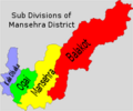
Mansehra District SubDiv.png 200 × 167; 13 KB
-
Mansehra District SubDiv.svg 1,867 × 1,557; 57 KB
-
Map 2 Kalashadesh.jpg 760 × 1,060; 65 KB
-
Miryan Tehsil.png 2,167 × 1,715; 1.64 MB
-
Mulagori Tehsil.png 2,983 × 1,660; 2.47 MB
-
Nawagai Tehsil.png 2,296 × 1,733; 1.8 MB
-
Orakzai District.png 3,065 × 1,108; 2.11 MB
-
Salarzai Tehsil.png 2,296 × 1,733; 1.8 MB
-
Sarai Naurang Tehsil.png 2,831 × 1,806; 2.25 MB
-
Upper Kurram Tehsil.png 1,933 × 1,556; 1.82 MB
-
Upper Orakzai Tehsil.png 3,065 × 1,108; 2 MB
-
Utmankhel Tehsil.png 2,296 × 1,733; 1.88 MB
-
Wazir Tehsil.png 2,167 × 1,715; 1.64 MB


