Category:Maps of districts of Tekirdağ Province
Jump to navigation
Jump to search
Media in category "Maps of districts of Tekirdağ Province"
The following 17 files are in this category, out of 17 total.
-
 Rodosto BG.png 670 × 600; 43 KB
-
 Tekirdağ (tr).svg 696 × 623; 20 KB
-
 Tekirdağ districts.png 1,008 × 767; 209 KB
-
 Tekirdağ Districts.svg 512 × 352; 355 KB
-
 Tekirdağ location districts.svg 854 × 752; 96 KB
-
 Tekirdağ-map-blank.svg 696 × 623; 18 KB
-
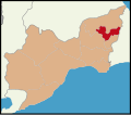
 Ergene-Harita.svg 854 × 752; 351 KB
-
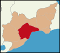
 Kapaklı-Harita.svg 854 × 752; 358 KB
-
 Tekirdağ location Hayrabolu.svg 854 × 752; 151 KB
-
 Tekirdağ location Malkara.svg 854 × 752; 151 KB
-
 Tekirdağ location Marmara Ereğlisi.svg 854 × 752; 151 KB
-
 Tekirdağ location Merkez.svg 854 × 752; 151 KB
-
 Tekirdağ location Muratlı.svg 854 × 752; 151 KB
-
 Tekirdağ location Saray.svg 854 × 752; 151 KB
-
 Tekirdağ location Çerkezköy.svg 854 × 752; 151 KB
-
 Tekirdağ location Çorlu.svg 854 × 752; 151 KB
-
 Tekirdağ location Şarköy.svg 854 × 752; 151 KB

.svg)


