Category:Maps of earthquakes in west of Macquarie Island
Jump to navigation
Jump to search
Media in category "Maps of earthquakes in west of Macquarie Island"
The following 10 files are in this category, out of 10 total.
-
 2021-03-20 Macquarie Island M6 earthquake intensity map (USGS).jpg 612 × 684; 66 KB
-
 2021-03-20 Macquarie Island M6 earthquake shakemap (USGS).jpg 784 × 1,001; 134 KB
-
 2021-03-20 Macquarie Island M6.1 earthquake intensity map (USGS).jpg 612 × 684; 67 KB
-
 2021-03-20 Macquarie Island M6.1 earthquake shakemap (USGS).jpg 784 × 1,001; 134 KB
-
 2021-05-07 Macquarie Island M6 earthquake shakemap (USGS).jpg 785 × 1,001; 134 KB
-
 2021-05-07 Macquarie Island M6.1 earthquake shakemap (USGS).jpg 785 × 1,001; 135 KB
-
 2021-12-12 Macquarie Island M6.5 earthquake shakemap (USGS).jpg 786 × 994; 141 KB
-
 2021-12-12 Macquarie Island M6.6 earthquake shakemap (USGS).jpg 786 × 992; 140 KB
-
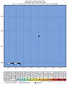
 2022-06-04 Macquarie Island M6.4 earthquake intensity map (USGS).jpg 612 × 684; 61 KB
-
 2022-06-04 Macquarie Island M6.4 earthquake shakemap (USGS).jpg 787 × 1,008; 81 KB
.jpg)
.jpg)
.jpg)
.jpg)
.jpg)
.jpg)
.jpg)
.jpg)
.jpg)
.jpg)