Category:Maps of education in Brazil
Jump to navigation
Jump to search
Subcategories
This category has the following 2 subcategories, out of 2 total.
B
- Maps of education in Bahia (12 F)
C
- Campus maps of Brazil (5 F)
Media in category "Maps of education in Brazil"
The following 21 files are in this category, out of 21 total.
-
Anos de estudo Brasil.png 4,184 × 4,256; 906 KB
-
BeteiligteProjekte Stand112017.png 1,713 × 875; 239 KB
-
Brazilian States (Literacy Rate).svg 677 × 683; 422 KB
-
Campus 2 USP-Sao Carlos.JPG 574 × 773; 63 KB
-
Estados brasileiros por anos de escolaridade (2019).png 804 × 764; 77 KB
-
Five states concentrate more than half of Brazilian PhD programmes.svg 418 × 318; 18.46 MB
-
IDH Educação.jpg 523 × 425; 49 KB
-
Illiteracy in Brazil.png 1,000 × 881; 105 KB
-
Map of the Brazilian regions by literacy rate (2019).svg 512 × 512; 172 KB
-
Map of the Brazilian states by literacy rate (2019).svg 512 × 512; 157 KB
-
Mapa de Pernambuco por IDH 2010 (2).png 985 × 478; 82 KB
-
Paraiba RedeUFCG.svg 1,680 × 990; 199 KB
-
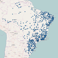
Polos uab.png 889 × 879; 634 KB
-
RioGrandedoNorte RedeUERN.svg 1,594 × 990; 160 KB
-
SaoPaulo RedeUNESP.svg 1,020 × 638; 579 KB
-
São Paulo dominates higher education spending on R&D.svg 400 × 371; 14.03 MB
-
Ufscampi.png 384 × 400; 40 KB
-
Unidades federativas do Brasil por índice educacional (2014).png 2,008 × 1,984; 280 KB


