Category:Maps of eyalets of the Ottoman Empire
Jump to navigation
Jump to search
Subcategories
This category has the following 2 subcategories, out of 2 total.
Media in category "Maps of eyalets of the Ottoman Empire"
The following 20 files are in this category, out of 20 total.
-
 1855 Colton Map of Turkey, Iraq, and Syria - Geographicus - TurkeyIraq-colton-1855.jpg 3,500 × 3,034; 3.22 MB
-

-
 Central europe 1572 hu.svg 922 × 880; 117 KB
-
 Central europe 1572.png 922 × 880; 120 KB
-
 Central Erope 1572 es.svg 1,122 × 883; 248 KB
-
 Central Erope 1572 HU.svg 1,122 × 883; 243 KB
-
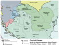 Central europe 1683.png 1,280 × 971; 406 KB
-
 Vassal states of the Ottoman Empire in 1683 hu.svg 877 × 688; 397 KB
-
 Vassal states of the Ottoman Empire in 1683.svg 877 × 688; 278 KB
-
 Vassal states of the Ottoman Empire in 1683-es.svg 2,557 × 2,000; 1.11 MB
-
 Vassal states of the Ottoman Empire in 1683-pt.svg 2,557 × 2,000; 583 KB
-
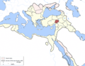
 Diyarbarik Eyalet, Ottoman Empire (1609).png 1,600 × 1,250; 1.27 MB
-
 Dulkadir Eyalet, Ottoman Empire (1609)-ar.png 1,600 × 1,250; 1.55 MB
-
 Dulkadir Eyalet, Ottoman Empire (1609).png 1,600 × 1,250; 1.27 MB
-
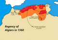 Eyalet Algeria in 1560.png 2,068 × 1,428; 1.53 MB
-
 Karesi-Saruhan Eyaleti.gif 350 × 438; 7 KB
-
 Srbsko Ottoman-es.svg 838 × 1,093; 243 KB
-
 Srbsko Ottoman.svg 785 × 1,024; 123 KB
-
 Szerbia az Oszmán Birodalom idején.svg 785 × 1,024; 123 KB
-
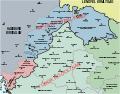
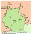 Uyvar eyalet.png 740 × 781; 40 KB

.jpg)


.png)
-ar.png)
.png)


