Category:Maps of fault zones in the United States
Jump to navigation
Jump to search
Subcategories
This category has the following 2 subcategories, out of 2 total.
F
W
Media in category "Maps of fault zones in the United States"
The following 27 files are in this category, out of 27 total.
-
 122-38HaywardFault.jpg 568 × 549; 88 KB
-
 USGS map of Imperial fault zone.gif 214 × 218; 16 KB
-
 San Gabiel fault.jpg 214 × 218; 61 KB
-
 Faultlines arround San Francisco.gif 568 × 549; 51 KB
-
 Geology of Lake Superior.jpg 600 × 404; 55 KB
-
 Hood Canal fault.png 186 × 294; 105 KB
-
 Laguna Salada fault - USGS map.gif 214 × 218; 17 KB
-
 Main faults of northern and central California.jpg 1,100 × 1,500; 403 KB
-
 Major California faults and ages of volcanics.png 1,202 × 758; 567 KB
-
 Major structural and tectonic features in the region of the Utica play (26796534595).jpg 3,507 × 2,480; 783 KB
-
 NYC Seis.png 438 × 868; 101 KB
-
 OFR 99-311 fig48.gif 856 × 686; 110 KB
-
 San andreas fault system los angeles basin.png 576 × 780; 201 KB
-
 Southern Washington Cascades conductor.png 472 × 660; 81 KB
-

-
 USGS - Benton Springs fault system.gif 214 × 218; 17 KB
-
 USGS - Newport-Inglewood-Rose Canyon fault zone.gif 214 × 218; 16 KB
-
 USGS - San Andreas fault zone.gif 214 × 218; 17 KB
-
 USGS - San Jacinto Fault Zone.gif 214 × 218; 16 KB
-
 USGS Garlock Fault Zone map.png 1,229 × 796; 1.65 MB
-
 USGS – Furnace Creek fault zone.gif 214 × 218; 17 KB
-
 USGS – Green Valley Fault.gif 214 × 218; 16 KB
-
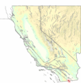
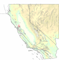
 USGS – Hayward Fault Zone.gif 214 × 218; 16 KB
-
 USGS – Honey Lake fault zone.gif 214 × 218; 17 KB
-
 USGS – Maacama fault zone.gif 214 × 218; 17 KB
-
 USGS – Pyramid Lake fault zone.gif 214 × 218; 17 KB
-
 USGS – Rodgers Creek fault zone.gif 214 × 218; 17 KB


.jpg)


_(14778489995).jpg)


