Category:Maps of forests in Yvelines
Jump to navigation
Jump to search
Departments of Metropolitan France: Ain [01] · Aisne [02] · Allier [03] · Alpes-de-Haute-Provence [04] · Hautes-Alpes [05] · Alpes-Maritimes [06] · Ardèche [07] · Ardennes [08] · Ariège [09] · Aube [10] · Aude [11] · Aveyron [12] · Bouches-du-Rhône [13] · Calvados [14] · Cantal [15] · Charente [16] · Charente-Maritime [17] · Cher [18] · Corrèze [19] · Corse-du-Sud [2A]† · Haute-Corse [2B]† · Côte-d’Or [21] · Côtes-d'Armor [22] · Creuse [23] · Dordogne [24] · Doubs [25] · Drôme [26] · Eure [27] · Eure-et-Loir [28] · Finistère [29] · Gard [30] · Haute-Garonne [31] · Gers [32] · Gironde [33] · Hérault [34] · Ille-et-Vilaine [35] · Indre [36] · Indre-et-Loire [37] · Isère [38] · Jura [39] · Landes [40] · Loir-et-Cher [41] · Loire [42] · Haute-Loire [43] · Loire-Atlantique [44] · Loiret [45] · Lot [46] · Lot-et-Garonne [47] · Lozère [48] · Maine-et-Loire [49] · Manche [50] · Marne [51] · Haute-Marne [52] · Mayenne [53] · Meurthe-et-Moselle [54] · Meuse [55] · Morbihan [56] · Moselle [57] · Nièvre [58] · Nord [59] · Oise [60] · Orne [61] · Pas-de-Calais [62] · Puy-de-Dôme [63] · Pyrénées-Atlantiques [64] · Hautes-Pyrénées [65] · Pyrénées-Orientales [66] · Bas-Rhin [67] · Haut-Rhin [68] · Rhône [69D]‡ · Haute-Saône [70] · Saône-et-Loire [71] · Sarthe [72] · Savoie [73] · Haute-Savoie [74] · Seine-Maritime [76] · Seine-et-Marne [77] · Yvelines [78] · Deux-Sèvres [79] · Somme [80] · Tarn [81] · Tarn-et-Garonne [82] · Var [83] · Vaucluse [84] · Vendée [85] · Vienne [86] · Haute-Vienne [87] · Vosges [88] · Yonne [89] · Territoire de Belfort [90] · Essonne [91] · Hauts-de-Seine [92] · Seine-Saint-Denis [93] · Val-de-Marne [94] · Val-d'Oise [95]
Subcategories
This category has only the following subcategory.
M
Media in category "Maps of forests in Yvelines"
The following 33 files are in this category, out of 33 total.
-
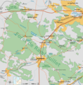
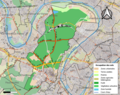
 Yvelines forets carte.svg 1,390 × 1,620; 208 KB
-
 Foret de Rambouillet version SVG.svg 2,340 × 2,377; 354 KB
-
 Foret-de-Rambouillet.png 1,144 × 1,162; 223 KB
-
 78006-Adainville-Sols.png 3,270 × 2,598; 1.41 MB
-
 78007-Aigremont-Sols.png 3,270 × 2,598; 1.44 MB
-
 78030-Auffargis-Sols.png 3,270 × 2,598; 2.26 MB
-
 78049-Bazemont-Sols.png 3,270 × 2,598; 1.69 MB
-
 78077-La Boissière-École-Sols.png 3,270 × 2,598; 1.74 MB
-
 78108-Les Bréviaires-Sols.png 3,270 × 2,598; 2.27 MB
-
 78120-Bullion-Sols.png 3,270 × 2,598; 1.71 MB
-
 78125-La Celle-les-Bordes-Sols.png 3,270 × 2,598; 1.4 MB
-
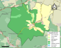
 78164-Clairefontaine-en-Yvelines-Sols.png 3,270 × 2,598; 2.09 MB
-
 78224-L'Étang-la-Ville-Sols.png 3,270 × 2,598; 2.39 MB
-
 78239-Follainville-Dennemont-Sols.png 3,270 × 2,598; 1.41 MB
-
 78264-Gambaiseuil-Sols.png 3,270 × 2,598; 1.47 MB
-
 78302-La Hauteville-Sols.png 3,270 × 2,598; 940 KB
-
 78329-Lainville-en-Vexin-Sols.png 3,270 × 2,598; 1.24 MB
-
 78398-Les Mesnuls-Sols.png 3,270 × 2,598; 1.3 MB
-
 78404-Millemont-Sols.png 3,270 × 2,598; 1.07 MB
-
 78437-Mousseaux-sur-Seine-Sols.png 3,270 × 2,598; 1.13 MB
-
 78497-Poigny-la-Forêt-Sols.png 3,270 × 2,598; 1.33 MB
-
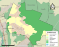
 78517-Rambouillet-Sols.png 3,270 × 2,598; 2.97 MB
-
 78522-Rochefort-en-Yvelines-Sols.png 3,270 × 2,598; 1.51 MB
-
 78537-Saint-Arnoult-en-Yvelines-Sols.png 3,270 × 2,598; 2.01 MB
-
 78551-Saint-Germain-en-Laye-Sols.png 3,270 × 2,598; 8.46 MB
-
 78561-Saint-Lambert-Sols.png 3,270 × 2,598; 1.14 MB
-
 78562-Saint-Léger-en-Yvelines-Sols.png 3,270 × 2,598; 1.94 MB
-
 78571-Saint-Nom-la-Bretèche-Sols.png 3,270 × 2,598; 2.54 MB
-
 78590-Senlisse-Sols.png 3,270 × 2,598; 1.46 MB
-
 78638-Vaux-sur-Seine-Sols.png 3,270 × 2,598; 2.67 MB
-
 78655-Vieille-Église-en-Yvelines-Sols.png 3,270 × 2,598; 1.99 MB
-
 78686-Viroflay-Sols.png 3,270 × 2,598; 4.95 MB
-
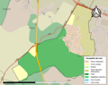
 Périmètre RNR Boucle de Moisson rnr203.png 1,197 × 883; 686 KB


