Category:Maps of former communes in Dordogne - intregrated within Brantôme en Périgord
Jump to navigation
Jump to search
Media in category "Maps of former communes in Dordogne - intregrated within Brantôme en Périgord"
The following 6 files are in this category, out of 6 total.
-
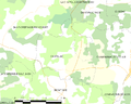 Map commune FR insee code 24079.png 756 × 605; 33 KB
-
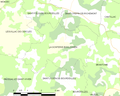
 Map commune FR insee code 24170.png 756 × 605; 30 KB
-
 Map commune FR insee code 24198.png 756 × 605; 36 KB
-
 Map commune FR insee code 24430.png 756 × 605; 27 KB
-
 Map commune FR insee code 24530.png 756 × 605; 23 KB
-
 Map commune FR insee code 24561.png 756 × 605; 31 KB


