Category:Maps of former communes of Luxembourg
Jump to navigation
Jump to search
Countries of Europe: Luxembourg
English: Periodically, communes are merged, divided, or their boundaries otherwise changed. All former communes, those that no longer exist, are included here. Those that are still in existence go in the following category: Category:Maps of municipalities of Luxembourg.
Media in category "Maps of former communes of Luxembourg"
The following 33 files are in this category, out of 33 total.
-
 Faarweg Kaart vun de Lëtzebuerger Gemengen.png 700 × 1,000; 397 KB
-
 Map Bascharage.PNG 203 × 270; 4 KB
-
 Map Bastendorf.PNG 203 × 270; 4 KB
-
 Map Boevange-sur-Attert.PNG 203 × 270; 6 KB
-
 Map Bous.PNG 203 × 270; 7 KB
-
 Map Burmerange.PNG 203 × 270; 4 KB
-
 Map Clemency.PNG 203 × 270; 4 KB
-
 Map Clervaux.PNG 203 × 270; 4 KB
-
 Communes of Luxembourg.PNG 203 × 270; 7 KB
-
 Map Consthum.PNG 203 × 270; 4 KB
-
 Map Ermsdorf.PNG 203 × 270; 4 KB
-
 Map Esch-sur-Sûre old.png 203 × 270; 4 KB
-
 Map Eschweiler.PNG 203 × 270; 3 KB
-
 Map Fouhren.PNG 203 × 270; 4 KB
-
 Gemeinde heiderscheid lux.png 203 × 270; 5 KB
-
 Map Heiderscheid.PNG 203 × 270; 4 KB
-
 Map Heinerscheid.PNG 203 × 270; 4 KB
-
 Map Hobscheid.PNG 203 × 270; 6 KB
-
 Map Hoscheid.PNG 203 × 270; 4 KB
-
 Map Hosingen.PNG 203 × 270; 4 KB
-
 Map Kautenbach.PNG 203 × 270; 4 KB
-
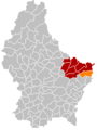
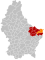
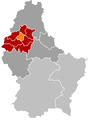 Map Wiltz 2012-2014.png 203 × 270; 3 KB
-
 Map Medernach.PNG 203 × 270; 4 KB
-
 Map Mompach.PNG 203 × 270; 6 KB
-
 Map Munshausen.png 203 × 270; 4 KB
-
 Map Neunhausen.PNG 203 × 270; 4 KB
-
 Map Rosport.PNG 203 × 270; 6 KB
-
 Map Schengen.png 203 × 270; 4 KB
-
 Map Septfontaines.PNG 203 × 270; 6 KB
-
 Map Tuntange.PNG 203 × 270; 6 KB
-
 Map Waldbredimus.PNG 203 × 270; 7 KB
-
 Map Wellenstein.PNG 203 × 270; 4 KB
-
 Map Wilwerwiltz.PNG 203 × 270; 4 KB


