Category:Maps of former municipalities in Aichi prefecture
Jump to navigation
Jump to search
日本語: 愛知県の廃止市町村の地図
Media in category "Maps of former municipalities in Aichi prefecture"
The following 62 files are in this category, out of 62 total.
-
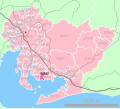
 Aichi Horai Town.png 210 × 155; 7 KB
-
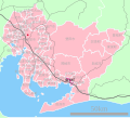
 Aichi Shimoyama Village.png 210 × 155; 7 KB
-
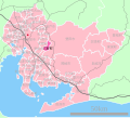
 Aichi Tsukude Village.png 210 × 155; 7 KB
-
 Aichi-haruhi-town.svg 561 × 506; 26 KB
-
 Aichi-hazu-town.svg 561 × 506; 26 KB
-
 Aichi-isshiki-town.svg 561 × 506; 26 KB
-
 Aichi-jimokuji-town.svg 561 × 506; 26 KB
-
 Aichi-kira-town.svg 561 × 506; 26 KB
-
 Aichi-kozakai-town.svg 561 × 506; 26 KB
-
 Aichi-mito-town.svg 561 × 506; 26 KB
-
 Aichi-miwa-town.svg 561 × 506; 26 KB
-
 Aichi-miyoshi-town.svg 561 × 506; 26 KB
-
 Aichi-nagakute-town.svg 561 × 506; 26 KB
-
 Aichi-otowa-town.svg 561 × 506; 26 KB
-
 Aichi-shippo-town.svg 561 × 506; 26 KB
-
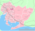
 Akabane Town, Aichi.png 210 × 155; 8 KB
-
 Consolidation of cities, towns, and villages in Aichi.png 210 × 155; 8 KB
-
 Hachikai village (Aichi).png 210 × 155; 8 KB
-
 Haruhi in Aichi Prefecture Ja.svg 660 × 672; 37 KB
-
 Hazu in Aichi Prefecture Ja.svg 539 × 484; 24 KB
-
 Heiwa town, Aichi.png 210 × 155; 8 KB
-
 Isshiki in Aichi Prefecture Ja.svg 539 × 484; 25 KB
-
 Jimokuji in Aichi Prefecture Ja.svg 539 × 484; 24 KB
-
 Kira in Aichi Prefecture Ja.svg 539 × 484; 24 KB
-
 Kozakai in Aichi Prefecture Ja.svg 539 × 484; 24 KB
-
 Map Inabu-Town Aichi.png 210 × 155; 5 KB
-
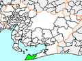 Map of Aichi Prefecture, showing Atsumi.png 210 × 155; 6 KB
-
 Map of Aichi Prefecture, showing Ichinomyia.png 210 × 155; 6 KB
-
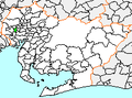
 Map of Aichi Prefecture, showing Jushiyama.png 210 × 155; 6 KB
-
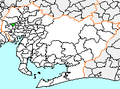
 Map of Aichi Prefecture, showing Kiyosu.png 210 × 155; 6 KB
-
 Map of Aichi Prefecture, showing Shippo.png 210 × 155; 6 KB
-
 Map.Asahi-Town.Aichi.PNG 210 × 155; 5 KB
-
 Map.Asuke-Town.Aichi.PNG 210 × 155; 5 KB
-
 Map.Bisai-City.Aichi.PNG 210 × 155; 5 KB
-
 Map.Fujioka-Town.Aichi.PNG 210 × 155; 5 KB
-
 Map.Kisogawa-Town.Aichi.PNG 210 × 155; 5 KB
-
 Map.Kiyosu-Town.Aichi.PNG 210 × 155; 6 KB
-
 Map.Nishibiwazima-Town.Aichi.PNG 210 × 155; 6 KB
-
 Map.Obara-Vil.Aichi.PNG 210 × 155; 5 KB
-
 Map.Shinkawa-Town.Aichi.PNG 210 × 155; 6 KB
-
 Miwa in Aichi Prefecture Ja.svg 539 × 484; 24 KB
-
 Miwa.png 210 × 155; 6 KB
-
 Nishiharu in Aichi Prefecture.png 1,140 × 1,024; 140 KB
-
 Nukata in Aichi Prefecture.png 1,140 × 1,024; 140 KB
-
 Saori town (Aichi).png 210 × 155; 8 KB
-
 Saya town (Aichi).png 210 × 155; 8 KB
-
 Shikatsu in Aichi Prefecure.png 1,140 × 1,024; 140 KB
-
 Shippo in Aichi Prefecture Ja.svg 539 × 484; 24 KB
-
 Sobue Town, Aichi.png 210 × 155; 8 KB
-
 Tatsuta village (Aichi).png 210 × 155; 8 KB
-
 Tomiyama.png 210 × 155; 6 KB
-
 Tsugu.png 210 × 155; 6 KB
-
 Ukr-Aichi-Haruhi.svg 527 × 471; 404 KB
-
 Ukr-Aichi-Hazu.svg 527 × 471; 403 KB
-
 Ukr-Aichi-Isshiki.svg 528 × 473; 409 KB
-
 Ukr-Aichi-Jimokuji.svg 528 × 473; 409 KB
-
 Ukr-Aichi-Kira.svg 528 × 473; 409 KB
-
 Ukr-Aichi-Kozakai.svg 528 × 473; 409 KB
-
 Ukr-Aichi-Miwa.svg 528 × 473; 409 KB
-
 Ukr-Aichi-Shippo.svg 528 × 473; 409 KB
-
 地図-愛知県幡豆町-2006.png 300 × 205; 6 KB
-
 地図-愛知県春日町-2006.png 300 × 205; 6 KB


.png)


.png)
.png)


.png)


