Category:Maps of former municipalities in Kyoto prefecture
Jump to navigation
Jump to search
日本語: 京都府の廃止市町村の地図
Media in category "Maps of former municipalities in Kyoto prefecture"
The following 21 files are in this category, out of 21 total.
-
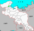 Iwataki.PNG 432 × 390; 11 KB
-
 Map.Amino-Town.Kyoto.PNG 216 × 196; 3 KB
-
 Map.Hiyoshi-Town.Kyoto.PNG 216 × 196; 3 KB
-
 Map.Iwataki-Town.Kyoto.PNG 216 × 196; 3 KB
-
 Map.Kaya-Town.Kyoto.PNG 216 × 196; 3 KB
-
 Map.Keihoku-Town.Kyoto.PNG 216 × 196; 3 KB
-
 Map.Kumihama-Town.Kyoto.PNG 216 × 196; 3 KB
-
 Map.Mineyama-Town.Kyoto.PNG 216 × 196; 3 KB
-
 Map.Miwa-Town.Kyoto.PNG 216 × 196; 3 KB
-
 Map.Miyama-Town.Kyoto.PNG 216 × 196; 3 KB
-
 Map.Mizuho-Town.Kyoto.PNG 216 × 196; 3 KB
-
 Map.Nodagawa-Town.Kyoto.PNG 216 × 196; 3 KB
-
 Map.Oe-Town.Kyoto.PNG 216 × 196; 3 KB
-
 Map.Omiya-Town.Kyoto.PNG 216 × 196; 3 KB
-
 Map.Sonobe-Town.Kyoto.PNG 216 × 196; 3 KB
-
 Map.Tanba-Town.Kyoto.PNG 216 × 196; 3 KB
-
 Map.Tango-Town.Kyoto.PNG 216 × 196; 3 KB
-
 Map.Wachi-Town.Kyoto.PNG 216 × 196; 3 KB
-
 Map.Yagi-Town.Kyoto.PNG 216 × 196; 3 KB
-
 Map.Yasaka-Town.Kyoto.PNG 216 × 196; 3 KB
-
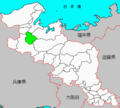 Ooe.PNG 432 × 390; 11 KB


