Category:Maps of geologic formations in Canada
Jump to navigation
Jump to search
Subcategories
This category has the following 4 subcategories, out of 4 total.
B
- Burgess Shale maps (3 F)
D
Media in category "Maps of geologic formations in Canada"
The following 6 files are in this category, out of 6 total.
-
 Bottom Brook Granite map.svg 512 × 458; 26.2 MB
-
 Gaultois Granite map.svg 512 × 458; 26.38 MB
-
 Nido Formation.png 439 × 910; 33 KB
-
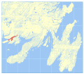
 Rencontre Formation map.svg 512 × 458; 26.29 MB
-
 Salmon River Dam Formation map.svg 512 × 458; 26.56 MB
-
 Tickle Point Formation map.svg 512 × 458; 26.23 MB


