Category:Maps of gminas of Poland
Jump to navigation
Jump to search
Subcategories
This category has the following 2 subcategories, out of 2 total.
O
- OpenStreetMap maps of Poland by gmina (1269 F)
Media in category "Maps of gminas of Poland"
The following 21 files are in this category, out of 21 total.
-
 02016 flats without a bathroom, GUS 2016.jpg 869 × 548; 174 KB
-
 Gemeinden Polen 2020.png 2,999 × 2,669; 3.14 MB
-
 Gminas in Poland abolished since 1973.png 6,000 × 5,805; 9.3 MB
-
 Gminas in Poland abolished since the reform of 1973.gif 7,322 × 7,084; 3.76 MB
-
 Poland - gminas (2019).svg 870 × 809; 3.76 MB
-
 Poland - gminas.svg 1,875 × 1,773; 3.36 MB
-
 Poland Gmina map Jan 2020.png 4,313 × 3,986; 5.18 MB
-
 Poland gminy.png 1,281 × 878; 106 KB
-
 Polska 49 i 16.PNG 2,041 × 1,895; 2.36 MB
-
 Polska aglomeracja kalisko-ostrowska WBPP Poznan 2010.png 2,041 × 1,895; 1.91 MB
-
 POLSKA mapa - gminy 2008-01-01.png 2,041 × 1,895; 1.5 MB
-
 POLSKA mapa woj z gminami.png 1,021 × 948; 728 KB
-
 POLSKA woj pow gminy.png 2,041 × 1,895; 1.6 MB
-
 Polska-adm 2015.png 19,183 × 17,837; 7.19 MB
-
 Sądy-apelacje.png 2,041 × 1,895; 2 MB
-
 Sądy-okręgi.png 2,041 × 1,895; 1.46 MB
-
 Woj49.png 2,041 × 1,895; 2.06 MB
-
 Woj49rejony.png 2,041 × 1,893; 441 KB
-
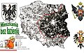
 Wojewodztwo warszawskie (Warsaw Voivodeship, II RP).png 5,196 × 5,665; 112.31 MB
-
 Wyniki rady gmin 2018.svg 800 × 744; 2.1 MB
-
 Wyniki wójtowie 2018.svg 800 × 744; 2.11 MB


.svg)


.png)

