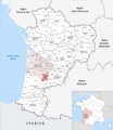
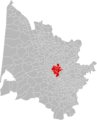
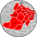
Category:Maps of groups of communes in Gironde to 2018
Jump to navigation
Jump to search
Media in category "Maps of groups of communes in Gironde to 2018"
The following 45 files are in this category, out of 45 total.
-
 Gemeindeverband Bassin d’Arcachon Nord 2018.png 3,500 × 4,020; 3.13 MB
-
 Gemeindeverband Bassin d’Arcachon Sud-Pôle Atlantique 2018.png 3,500 × 4,020; 3.13 MB
-
 Gemeindeverband Bazadais 2018.png 3,500 × 4,020; 3.13 MB
-
 Gemeindeverband Blaye 2018.png 3,500 × 4,020; 3.13 MB
-
 Gemeindeverband Bordeaux Métropole 2018.png 3,500 × 4,020; 3.13 MB
-
 Carte des communes EPCI Médoc-Estuaire.png 570 × 546; 63 KB
-
 Gemeindeverband Castillon-Pujols 2018.png 3,500 × 4,020; 3.16 MB
-
 CDC Blaye.png 1,000 × 1,234; 199 KB
-
 CDC Castillon-Pujols.png 1,000 × 1,234; 199 KB
-
 CDC Créonnais.png 1,000 × 1,234; 200 KB
-
 CDC Cœur Médoc Presqu'île.png 1,000 × 1,234; 198 KB
-
 CDC du Grand Cubzaguais.png 1,000 × 1,234; 199 KB
-
 CDC Estuaire - Saint-Ciers.png 1,000 × 1,234; 199 KB
-
 CDC Latitude Nord-Gironde.png 1,000 × 1,234; 200 KB
-
 CDC Médoc Estuaire.png 1,000 × 1,234; 200 KB
-
 CDC Sud-Gironde - Communes.png 612 × 561; 233 KB
-
 CDC Sud-Gironde.png 1,000 × 1,234; 197 KB
-
 Gemeindeverband Convergence Garonne 2018.png 3,500 × 4,020; 3.13 MB
-
 Gemeindeverband Coteaux Bordelais 2018.png 3,500 × 4,020; 3.13 MB
-
 Gemeindeverband Créonnais 2018.png 3,500 × 4,020; 3.13 MB
-
 Gemeindeverband Estuaire - Canton de Saint-Ciers-sur-Gironde 2018.png 3,500 × 4,020; 3.13 MB
-
 Gemeindeverband Fronsadais 2018.png 3,500 × 4,020; 3.13 MB
-
 Gemeindeverbände im Département Gironde 2018.png 3,500 × 4,020; 3.15 MB
-
 Gironde - Intercommunalités 2018.png 1,000 × 1,234; 188 KB
-
 Gemeindeverband Grand Cubzaguais 2018.png 3,500 × 4,020; 3.13 MB
-
 Gemeindeverband Grand Saint-Émilionnais 2018.png 3,500 × 4,020; 3.13 MB
-
 Gemeindeverband Jalle-Eau-Bourde 2018.png 3,500 × 4,020; 3.13 MB
-
 Gemeindeverband Latitude Nord Gironde 2018.png 3,500 × 4,020; 3.13 MB
-
 Gemeindeverband Libournais 2018.png 3,500 × 4,020; 3.13 MB
-
 Localisation Communauté d'agglomération du Libournais.png 1,000 × 1,234; 198 KB
-
 Localisation EPCI CC rurales de l'Entre-deux-Mers 2019.png 1,000 × 1,234; 198 KB
-
 Localisation EPCI Entre-Deux-Mers dans la Gironde, France.svg 1,000 × 1,234; 201 KB
-
 Localisation EPCI Médoc Atlantique dans la Gironde, France.svg 1,000 × 1,234; 208 KB
-
-
 Gemeindeverband Montesquieu 2018.png 3,500 × 4,020; 3.13 MB
-
 Gemeindeverband Médoc Atlantique 2018.png 3,500 × 4,020; 3.13 MB
-
 Gemeindeverband Médoc Cœur de Presqu’île 2018.png 3,500 × 4,020; 3.13 MB
-
 Gemeindeverband Médoc Estuaire 2018.png 3,500 × 4,020; 3.13 MB
-
 Gemeindeverband Médullienne 2018.png 3,500 × 4,020; 3.13 MB
-
 Gemeindeverband Portes de l’Entre-Deux-Mers 2018.png 3,500 × 4,020; 3.13 MB
-
 Gemeindeverband Rurales de l’Entre-Deux-Mers 2018.png 3,500 × 4,020; 3.13 MB
-
 Gemeindeverband Réolais en Sud Gironde 2018.png 3,500 × 4,020; 3.13 MB
-
 Gemeindeverband Secteur de Saint-Loubès 2018.png 3,500 × 4,020; 3.13 MB
-
 Gemeindeverband Sud Gironde 2018.png 3,500 × 4,020; 3.13 MB
-
 Gemeindeverband Val de l’Eyre 2018.png 3,500 × 4,020; 3.13 MB


