Category:Maps of lakes
Jump to navigation
Jump to search
Subcategories
This category has the following 14 subcategories, out of 14 total.
Media in category "Maps of lakes"
The following 76 files are in this category, out of 76 total.
-
 10 Largest Lakes.png 2,759 × 1,404; 95 KB
-

-

-
 Agassiz.jpg 2,832 × 2,163; 6.82 MB
-
 Alausa 1870 Bisliu viensodija.jpg 1,031 × 1,021; 134 KB
-
 B. Everett Jordan Lake Map.png 3,944 × 3,001; 14.11 MB
-
 B. Everett Jordan Lake map.svg 2,149 × 1,775; 645 KB
-
 B. Everett Jordan Lake Map.tif 4,795 × 3,672; 30.33 MB
-
 B. Everett Jordan Lake vicinity.svg 570 × 436; 116 KB
-
 Bayernsee.png 834 × 640; 91 KB
-
 Big Creek Reservoir map.png 631 × 530; 38 KB
-
 Champlainmap fr.svg 465 × 470; 99 KB
-
 Champlainmap.png 465 × 470; 36 KB
-
 Depth Chart of Seymour Lake, Vermont, 2013.jpg 1,700 × 2,200; 405 KB
-

-
 FMIB 37741 Sunapee Lake, New Hampshire.jpeg 921 × 2,108; 746 KB
-

-
 Fuller projection with largest lakes by area.svg 512 × 341; 553 KB
-
-
 GlacialLakeWisconsin.jpg 2,088 × 2,280; 477 KB
-
 Harta veche Codrii Vlăsiei de prin 16xx.jpg 1,600 × 867; 413 KB
-
 Havel bei Werder.png 2,005 × 2,315; 727 KB
-
 John H. Kerr Reservoir Map.pdf 3,600 × 2,700; 3.38 MB
-
 Karte walchensee.png 200 × 139; 11 KB
-
 Killebrew Park Lake Blackshear map.jpg 5,184 × 3,456; 6.4 MB
-
 Lacu Rosu-map.jpg 1,797 × 1,637; 427 KB
-
 Lagekarte zum Großen Plessower See.png 2,005 × 2,315; 924 KB
-
 Lago de Texcoco-descriptivo.png 778 × 1,017; 296 KB
-
 Lago embalse Alicura provincia del Neuquen.svg 1,095 × 509; 38 KB
-
 Lago embalse arroyito provincia del Neuquen.svg 1,095 × 509; 35 KB
-
 Lago embalse Pichi Picun Leufu provincia del Neuquen.svg 1,095 × 509; 38 KB
-
 Lago embalse piedra del aguila provincia del Neuquen.svg 1,095 × 509; 59 KB
-
 Lake Amaramba.png 536 × 592; 347 KB
-
 Lake ellesmere outline.png 383 × 267; 4 KB
-
 Lake Golovița.svg 983 × 711; 144 KB
-
 Lake Monkey Business.png 614 × 450; 155 KB
-
 Lake Papakeechie blue green.jpg 622 × 500; 35 KB
-
 Lake Papakeechie.png 726 × 600; 20 KB
-
 Map-shikotsu.png 600 × 500; 176 KB
-
 Lake statistics map.webp 946 × 1,213; 243 KB
-
 Lake te whanga lagoon outline.png 275 × 414; 5 KB
-
 Lake-Texoma-Map.gif 350 × 337; 32 KB
-
 Lakebalkhashbasinmap hu.svg 1,955 × 1,333; 2.05 MB
-
 Lakebalkhashbasinmap.png 1,466 × 1,000; 1.52 MB
-
 Loon Lake Sample Sites.jpg 662 × 332; 52 KB
-
 Map of Buncannia Lake, Newe South Wales.png 1,280 × 1,024; 48 KB
-
 Mapa da Barragem de Sobradinho na Bahia - Brasil.svg 1,286 × 856; 3.64 MB
-
 Mapa del lago Filo Hua Hum en la provincia del Neuquén Argentina.svg 1,095 × 509; 32 KB
-
 Mapa jezera Savica.jpg 3,456 × 5,184; 7.74 MB
-
 Mapa Laguna Blanca Provincia del Neuquen.svg 800 × 800; 42 KB
-
 Mecklenburg-Vorpommern Gewässer.png 1,562 × 1,190; 117 KB
-
 Parasite140042-fig1 Clinostomum phalacrocoracis metacercariae.tif 1,102 × 1,509; 732 KB
-
 PSM V45 D264 Lake forms due to erosion or submersion.jpg 1,793 × 2,948; 276 KB
-
 Sessional papers of the Dominion of Canada 1914 (1914) (14595714367).jpg 3,264 × 2,198; 386 KB
-
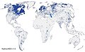
 Share-of-land-covered-by-lakes-and-rivers.png 3,400 × 2,400; 745 KB
-
 Map of Ukraine political simple blank.svg 700 × 480; 149 KB
-
 Wabee Lake Indiana Map.png 516 × 500; 25 KB
-
 Аматовско и Арџанско Езеро.png 1,959 × 1,982; 3.29 MB
-
 Бешичко Езеро.png 1,959 × 1,982; 4.91 MB
-
 Бутковско Езеро.png 1,943 × 1,965; 5.18 MB
-
 Витивјанско Езеро.png 1,959 × 1,982; 5.67 MB
-
 Горчливо Езеро.png 777 × 786; 712 KB
-
 Езеро Козјак.png 1,959 × 1,982; 6.75 MB
-
 Ениџевардарско Езеро.png 1,959 × 1,982; 1.65 MB
-
 Зазерци и Рудничко Езеро.png 1,959 × 1,982; 4.66 MB
-
 Костурско Езеро.png 1,959 × 1,982; 4.59 MB
-
 Лагадинско Езеро.png 1,959 × 1,982; 5 MB
-
 Мало Преспанско Езеро.png 1,959 × 1,982; 4.91 MB
-
 Нуурын тархалт газрын зураг.jpg 2,160 × 1,332; 767 KB
-
 Островско и Петерско Езеро.png 1,959 × 1,982; 4.62 MB
-
 Охридско Езеро.png 1,959 × 1,982; 5.32 MB
-
 Преспанско Езеро.png 1,959 × 1,982; 5.8 MB
-
 Тахинско Езеро.png 2,123 × 1,982; 4.97 MB
-
 Черешовско Езеро.png 1,959 × 1,982; 7.95 MB
-
 البحيرات العظمى (أمريكا الشمالية).png 786 × 533; 82 KB
-
 حوض البحيرات العظمى (أمريكا الشمالية).png 736 × 525; 116 KB

.jpg)


_(14595714367).jpg)


.png)
.png)